Good Evening,

Ever since I have started this project there have been lakes or groupings of lakes that people are always intrigued by.
When I tell them about what I’m doing, they get wild eyed and come up with the most remote, ridiculously hard, off trail lakes in the park and ask “Have you done this or that”?
One of the most commented on is a group of lakes near the Canadian border called the Northern Boundary Lakes. There are five of them and the last two fell on Tuesday.
So, I raise my glass to those five, because they have put up a heck of a fight.
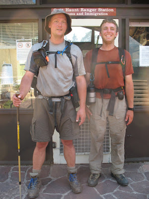
On Tuesday, my friends Pat and Brian and I went to Carcajou Lake and Wahseeja Lake.
Jump Stats brought to you by The Jump Tracker 3000
-

Waseeja Lake - Jump #120
Lake: Carcajou and Wahseeja Lakes
-
Lake Jump: #119 & #120
-
Completion Date: August 18, 2009
-
Distance: 13 miles
-
Difficulty: RIDICULOUS
-
Off Trail Distance: 6 miles
-
Elevation Change: 4000 feet
-
Length of Trip: 1 day
-
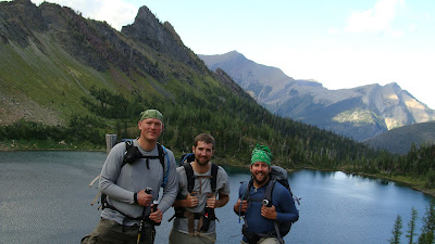
Lake Jumpers in attendance: Brian Roys & Pat Catalino
But, before that we had large plates of Cincinnati Chili.
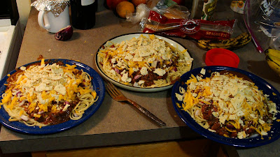 For anyone who knows about this delicacy, you understand how happy I was to have a communal chili feed in the middle of nowhere.
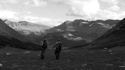
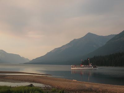
The next morning with a chili bomb in our stomachs we headed north to the northern boundary trail which is about four miles north of Goat Haunt.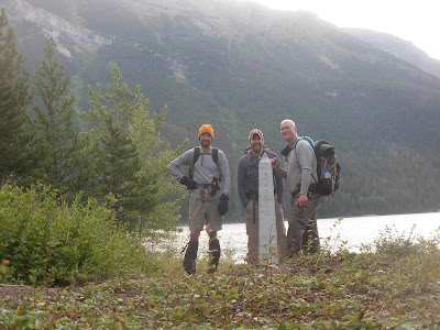 We said hello to the obelisk that marks the border and we headed west three and a half miles till we saw an entrance to a heavily wooded side valley that no one I have ever met has gone up.
 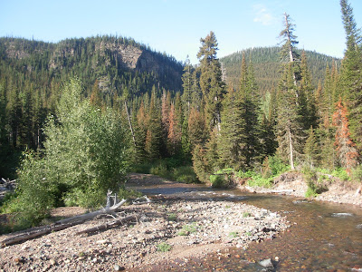 I’m sure its happened, but boy oh boy… would it be few and far between.
We had to cross Boundary Creek which luckily we had a few good logs to work across. 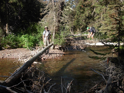 Then into the guts we go.
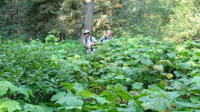
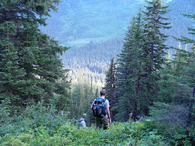
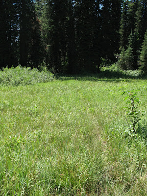
It started off quite nice with some lovely meadow filled stretches.
 That always ends and gives way to a thick tree filled mess.

This year has been one of the wettest on record. With rain come mushrooms. They were everywhere.
Huge ones.
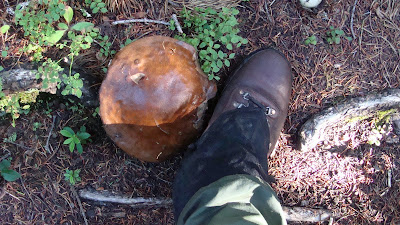
Weird ones.
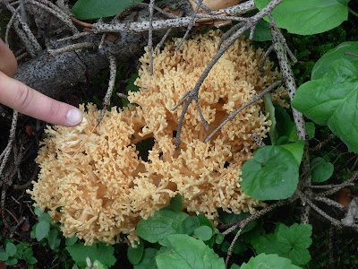
Also, that means that it was just wet. It had not rained in days, but the whole area was just moist.
Great moss.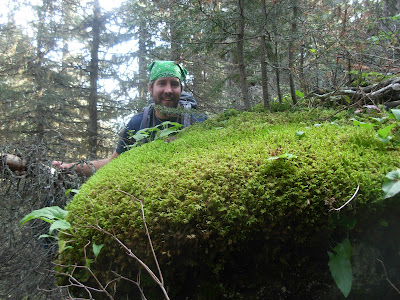
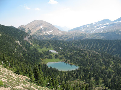
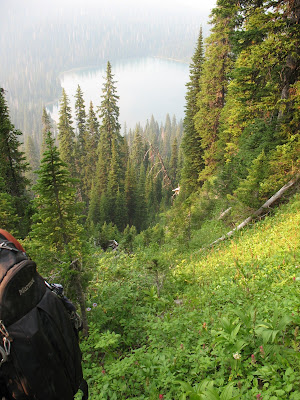
After many hours working up a steep wooded valley we eventually dropped down to the creek that drains Carcajou Lake. 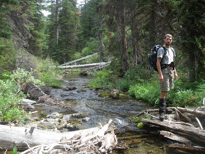 Shortly after crossing it, we finally came to the first of our objectives.
Carcajou Lake.
We frolicked in the lake for a good while to get rid of the pine needles, grit and grime. 
It was quite pleasant.
We took a nice little while here; even long enough for Pat to take a cat nap on the lake shore. 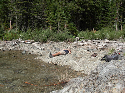
But, we had to keep going. There is no stopping and we had a long way to go. 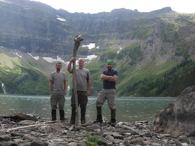 We were essentially going from one main valley to the next, but over, under and through the middle of nowhere.
We headed back out with the need to climb over a ridge to the lake on the other side.
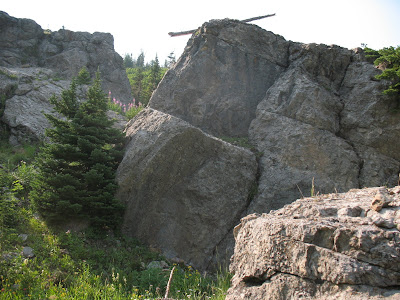
It was thick and steep.
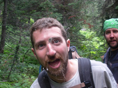
And hot! I had to wring out my bandana….Wanna see?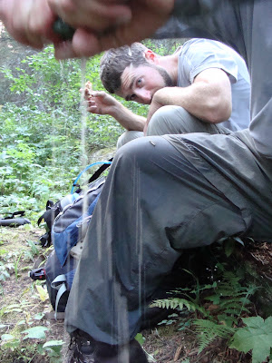
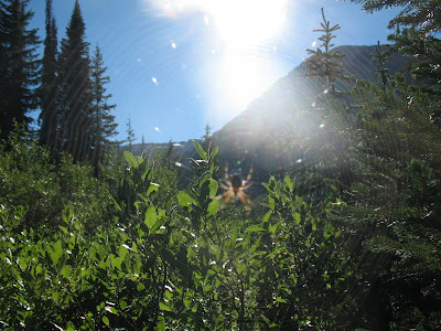
Along the way Brian made a friend.
We eventually just grabbed hand fulls of vegetation and pulled ourselves up a thousand feet of steep mess. 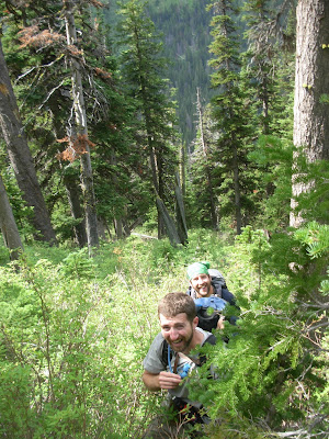
Luckily when we got towards the top, the blessed animals of Glacier National Park started to hook us up a bit. There was a perfect game trail over the top of the ridge that went on for a good while in the exact direction that we were headed. 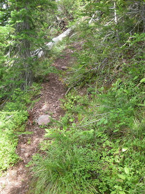
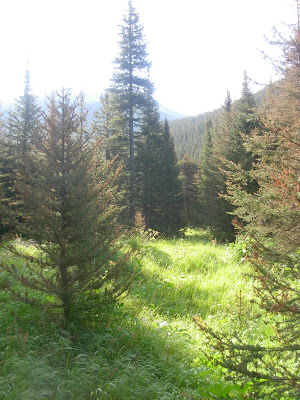
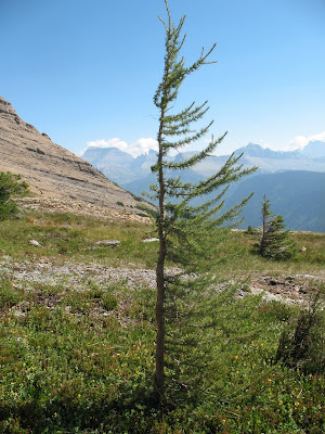
It was amazing on the other side.
Lots of flower choked meadows.
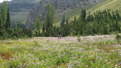
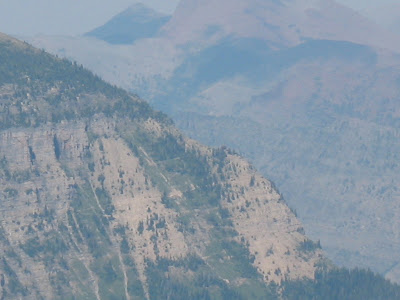
If nothing else, just easier going since it was much more open. With that came huge views of the surrounding mountains.
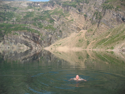
In a past endeavor with a friend Matt I looked down on Wahseeja Lake.
I have been waiting for a long time to get back to it.
(I would also like to note that Matt just informed me today his wife Allison is pregnant!! Lets all raise a glass to their lovely, healthy, very tiny baby to be!!! )
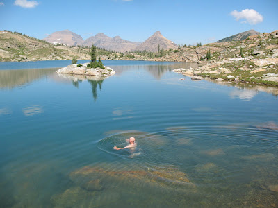
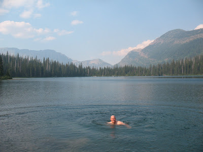
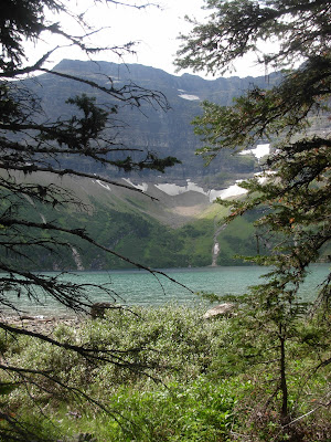
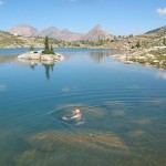
Anyway it was very rewarding to get to this absolutely amazing lake. This was easily one of the most lovely that I have been to in all my time in the park. 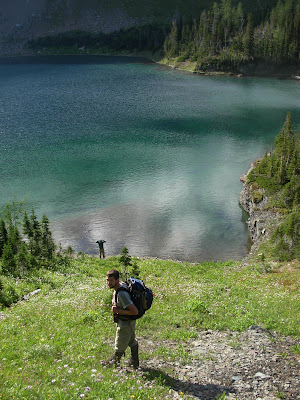
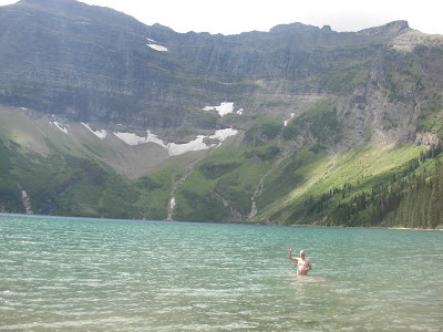
We enjoyed it to the fullest. Seldom is there a perfect, large rock to jump off of. Well there is in Wahseeja Lake.
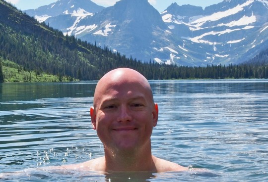
As to not carry around a bunch of wet clothes we all went naked.
So, fortunatly you get to just see a picture of me in the lake instead… No jumping pics.
But, like everything else in life, this too had to end.
There was a saddle about 300 feet above the lake that we had to get to and over. 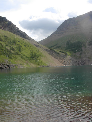
On the other side was our destiny.
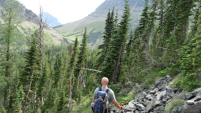
A 2000 foot steep grade going straight down towards Lake Francis and Lake Janet.
There was still many miles to go, onward and upward.
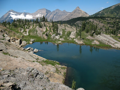
Only time for one last group picture of the lake.
 Man that thing is nice.
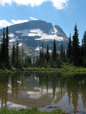
The saddle proved to be big and wide.
It also had huge views of Mount Cleveland which is the highest peak in the park. 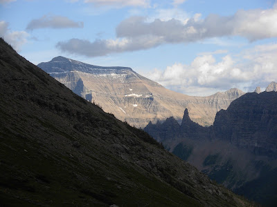
This hike just kept getting better. 
But, down we went into the abyss. Not too bad, in relative terms. I guess the schwack up the Carcajou side of the trip was so nasty that this seemed quite tame. 
2000 feet of extremely steep tame, but tame none the less.
Happily we gained the valley floor and headed our five more miles of trail back towards Goat Haunt.
A lovely sunset on the peaks above escorted us back to where we started.

I would like to extend a huge thank you to Pat and Brian. This was a very large endeavor and probably two of the ten hardest lakes that I have left in the park.
Without them I would not have just checked off lakes number 120 and 121.
All the best to everyone reading and to all a good night.
Ho Ho Ho

To Life,
Marc

 My partner in crime, Brad and I hiked five miles south before sunset.


 A wild place where, Brad saw a wolf for a split second, before it dipped back into vegetation.
 When I neared the end, I noticed I had lost one of my prize trekking poles. I looked for 20 minutes, but it was gone, gobbled up by the alder bushes.
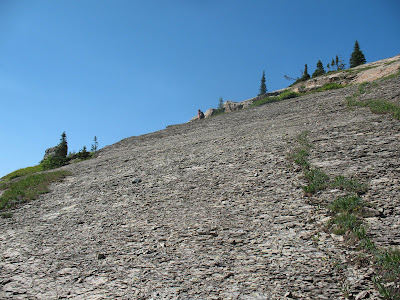 and angular streches of slick vegetation, but it was also early in the day and we over came this section in about an hour.
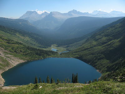 Our camp was at the far end of this lake towards the mountains.
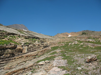

 Gyrfalcon Lake has been on the agenda for years, to finally arrive was pretty great for me.