Marc Ankenbauer's 10+ year quest to jump in every named lake in Glacier and Waterton National Parks for charity.
168 lakes. Only 17 16 15 14 13 12 11 10 9 8 7 6 5 4 3 2 1
ZERO LAKES LEFT!!!
-- Marc jumped into Fisher Cap Lake on Sunday September 8th, 2013 to complete his goal! --
Read about Marc and how this project started...

Carthew Pond : The Last Canadian Lake #162

One of the greatest aspects to the seasonal world of Glacier National Park is the people you call your peers.

It’s not about who you were in the past or even who you are in winter.

Right now, maybe just for this summer… you are the lucky few.

Right now you are here, no matter what demographic life would normally put you in.

No matter your age, gender, color, sexual preference, nationality, hometown or future path, when you’re here…

None of that matters.


What matters is that you bled your time in this park for all its was worth.

It matters that you got out and explored the park in your own particular way this past weekend.

It matters that you were overwhelmed by the power of this place and your moments in it.

Carthew 1


Some of my best friends in Glacier were not born in my same generation much less the same decade.

I often find myself sitting around a fire or planning hikes with people 15 years younger and 30 years older than me.

I feel lucky to call some of the parks greatest personalities, my friends.


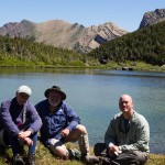
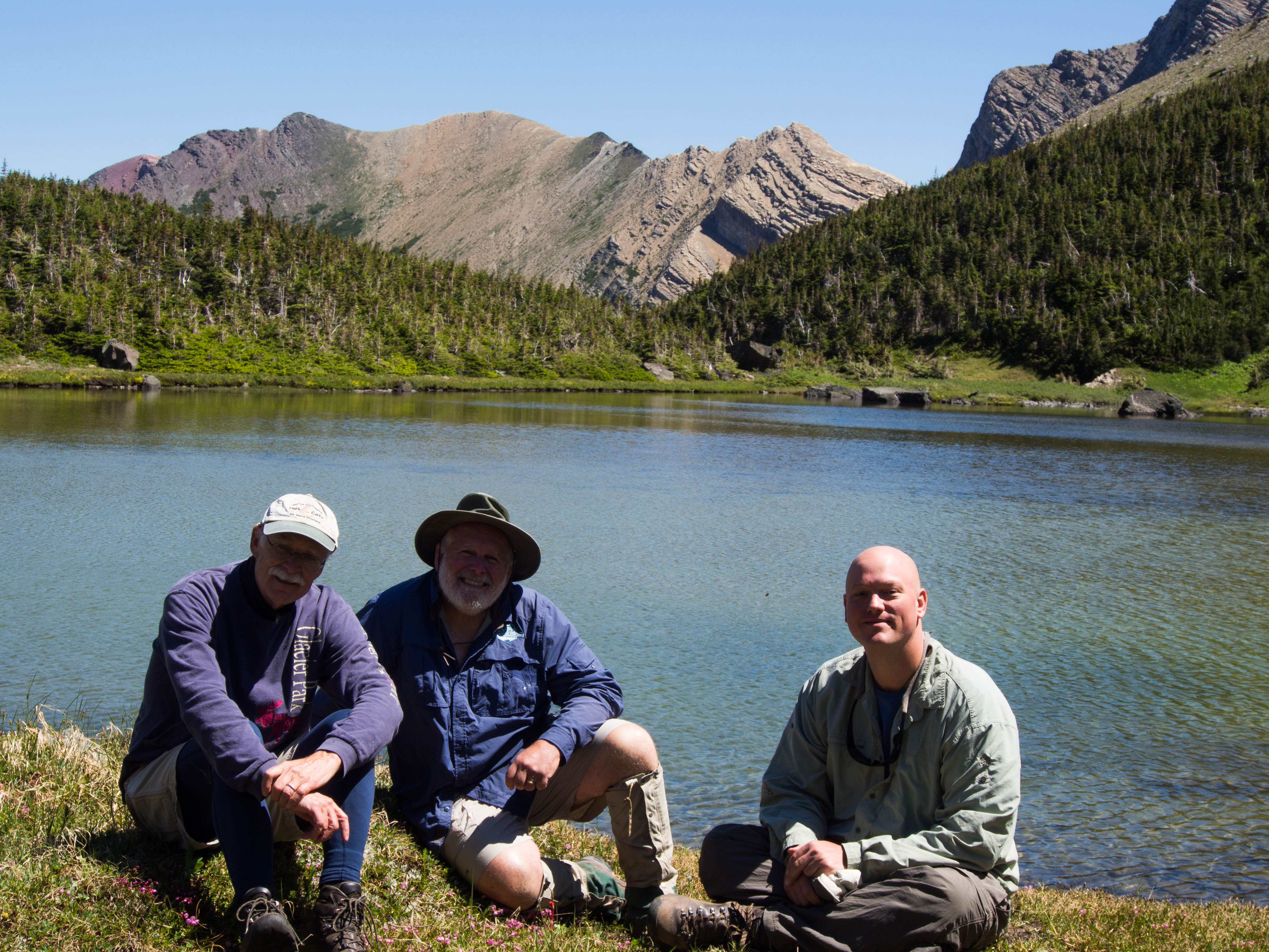
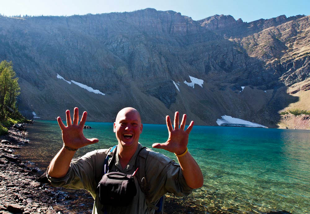
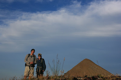
With that said, I have two wonderful guys named Ed Bouffard and Dave Birkhead as hiking partners.

Their lovely wives Diane and Kathy are even more amazing than them… but this story is about Ed and Dave.


Carthew 2


Heading into this season, I was pondering the ideal hiking partners for the last 10 lakes.

Virtually everything I had was a brutal, multiday, off trail outing.

But, there was one last amazing day hike to be had and my ideal partners were these two guys.

They have been good friends to me and unendingly supportive of the lake project.

I’ve gone on countless outings with these two and I always have a terrific time.

Both of them more than hold their own, they’re impressive hikers.


Carthew 3


So, when Ed called me to ask what I was doing on a random Monday in mid-July, I knew exactly what was on the agenda.

Luckily it was Dave’s day off also and we were going to knock off Carthew Pond.

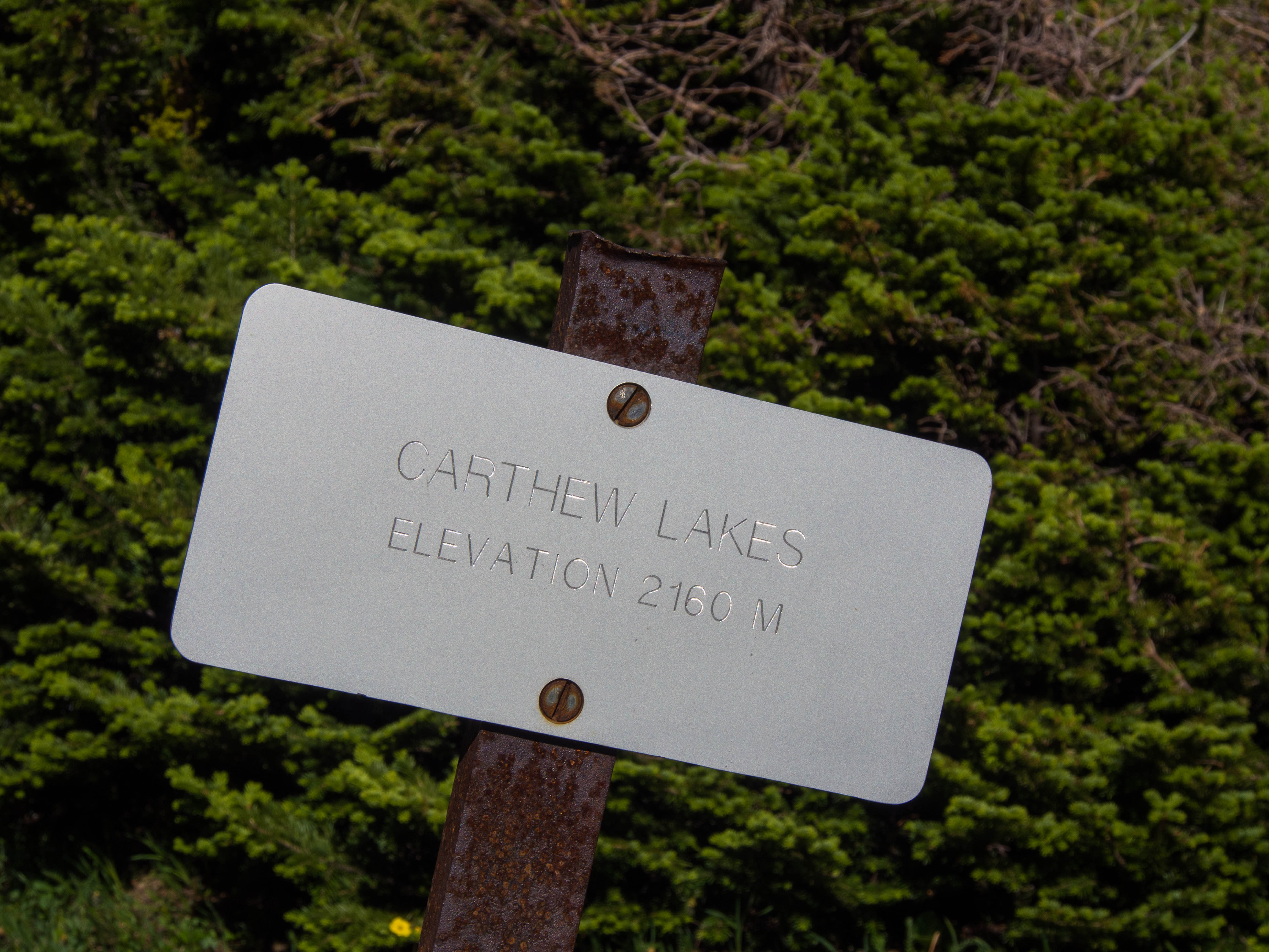
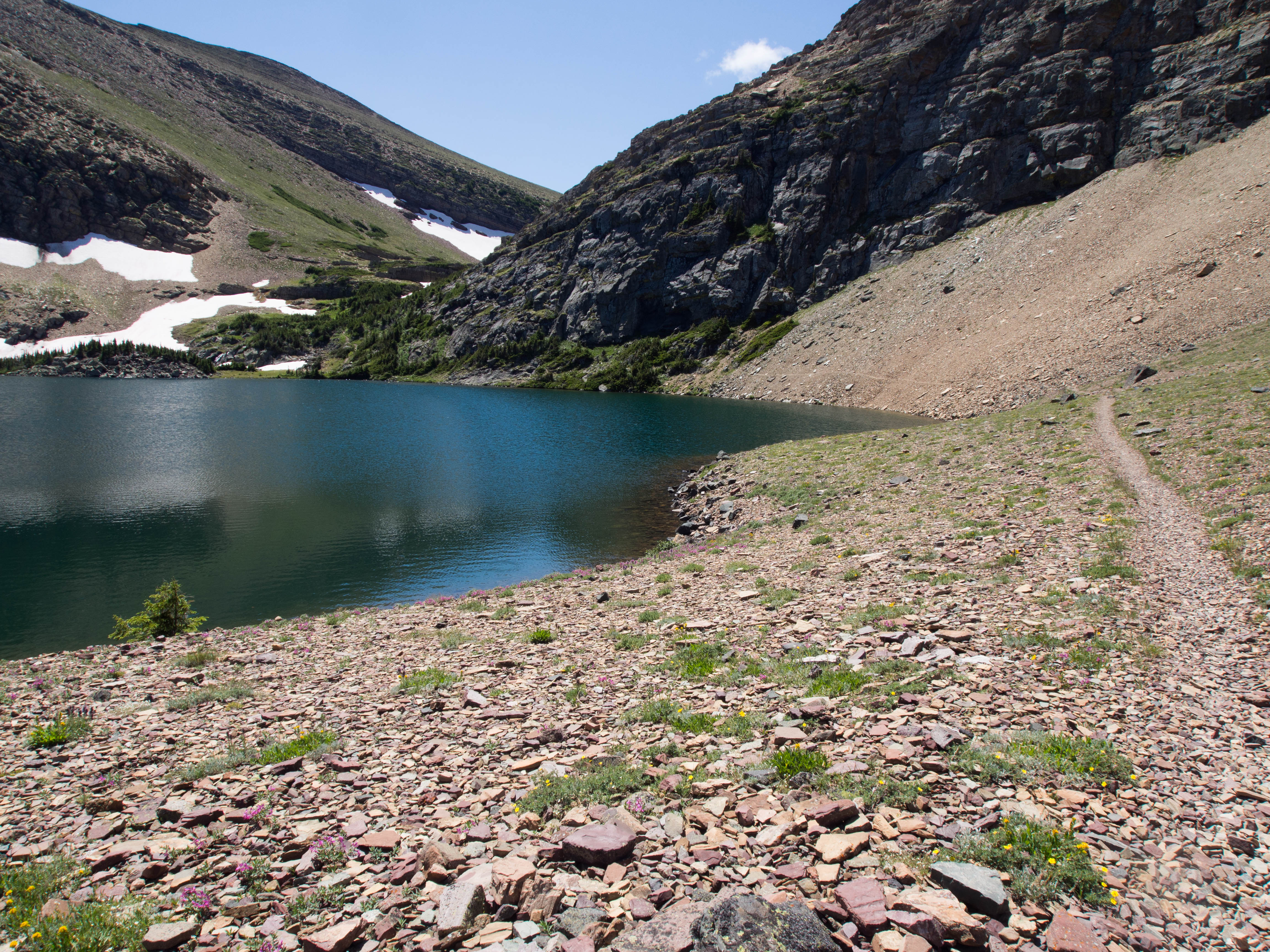
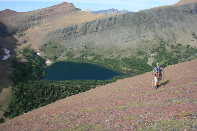
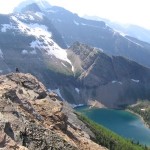
This shallow pond below the Carthew Lakes in Waterton National Park also represented THE LAST LAKE IN CANADA.

There are 38 in Canada, and this was number 38.


Carthew 26

Carthew Pond that is…


In 2004 I hiked through this area along the famous Carthew-Alderson trail.

I knocked off six lakes that day, but not this one.

Carthew Pond wasn’t even on my radar as I hadn’t looked at the official Waterton Lake list yet.

I was simply knocking off the obvious lakes anywhere I found myself on a pretty day.

It’s been almost ten years since I passed by this tiny, somewhat overshadowed pond.


Carthew 4


Unfortunately, the June floods that wreaked havoc in Calgary also took out the Akamina road which accesses Cameron Lake trailhead.

The hike normally runs from Cameron Lake over Carthew Peak and down to Waterton Townsite.


Carthew 28

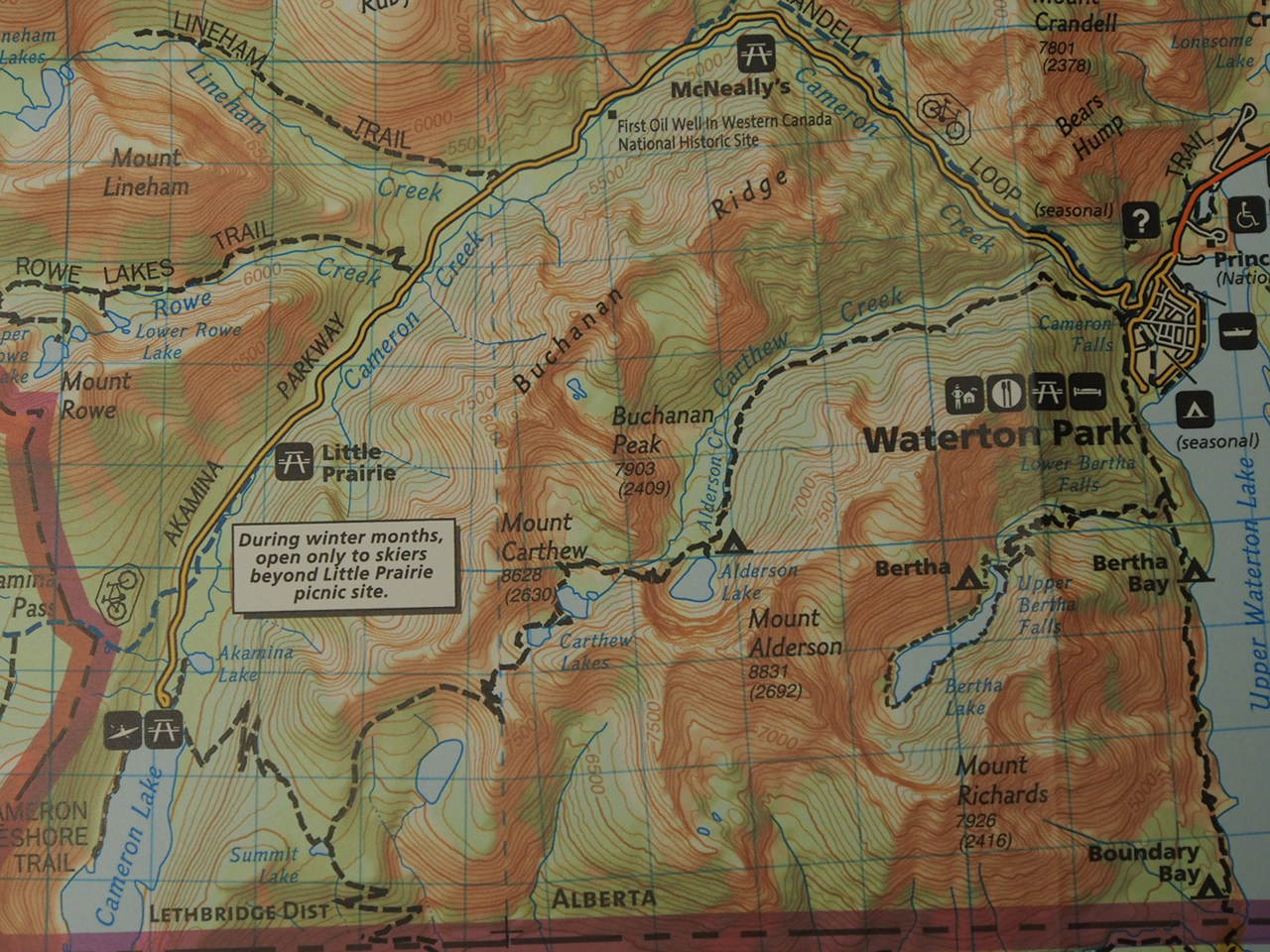
Carthew Alderson Route Map


Instead, now it’s a seven mile, 3000’ push one way from town to the pond and then back down again.

Not exactly the ideal route, but it was time to go swimming and that’s what we were going to do.


Carthew 5


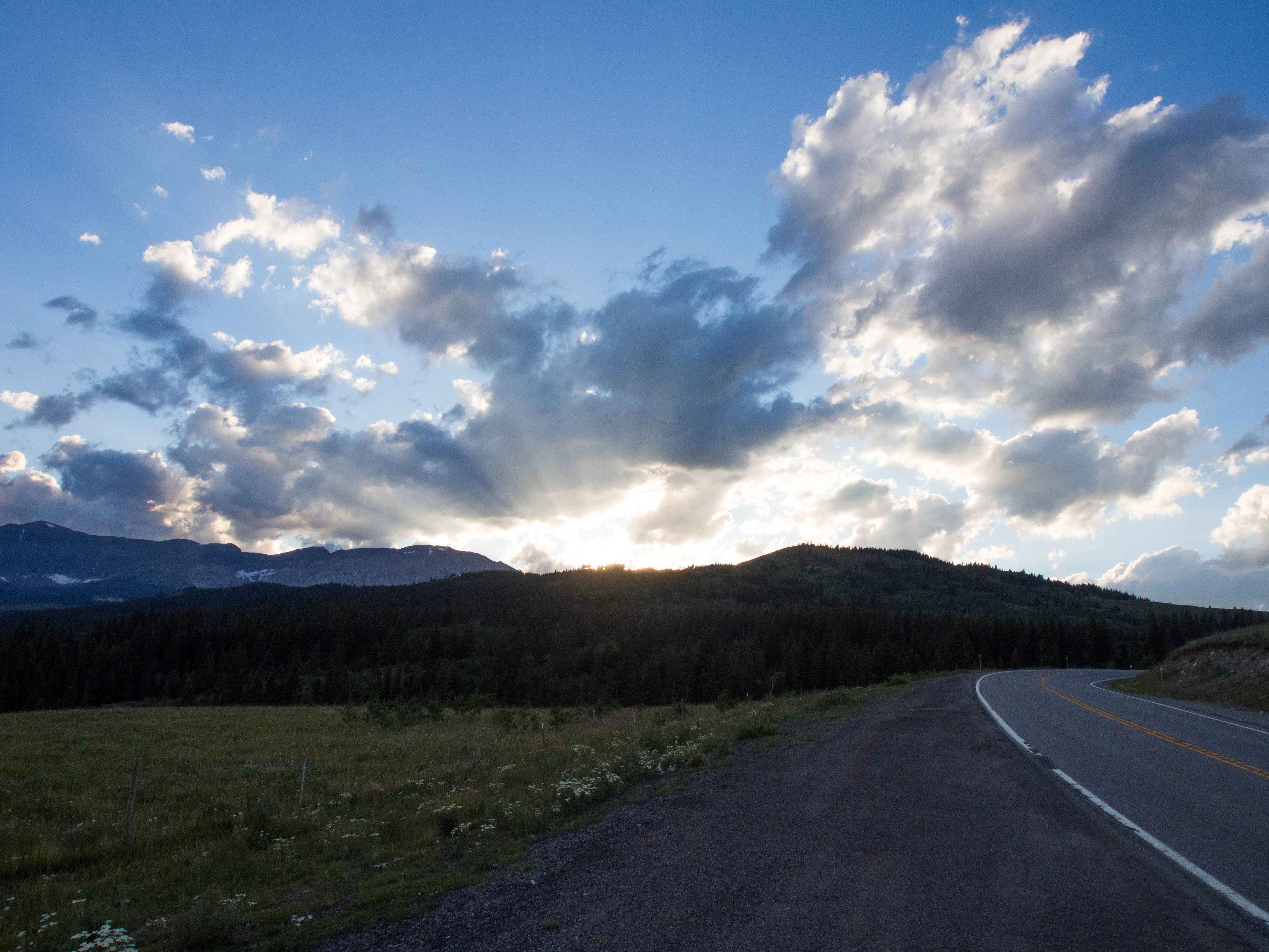
The day hedged on perfect as I drove north rocking out to the new Macklemore CD.

I pulled up next to Dave’s apartment with music blaring, windows rolled down and my car looking like I live in there.

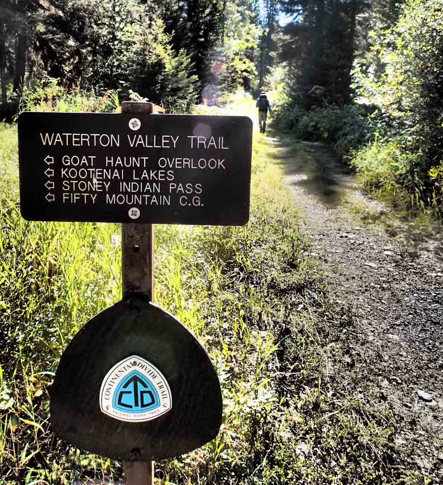
Dave hopped in and we continued towards Babb to meet Ed, and grabbed a hitch hiker along highway 89.

He told us that he was starting the Continental Divide Trail.

He was hitching north to the Canadian border so he could start heading South towards Mexico.


Interesting story; I was the 3rd person to pick him up already this morning and the first person was one of my coworkers.

Ah, the small world that is the east side of Glacier NP.

We wished him safe travels as he headed in for a last meal at the diner in Babb.

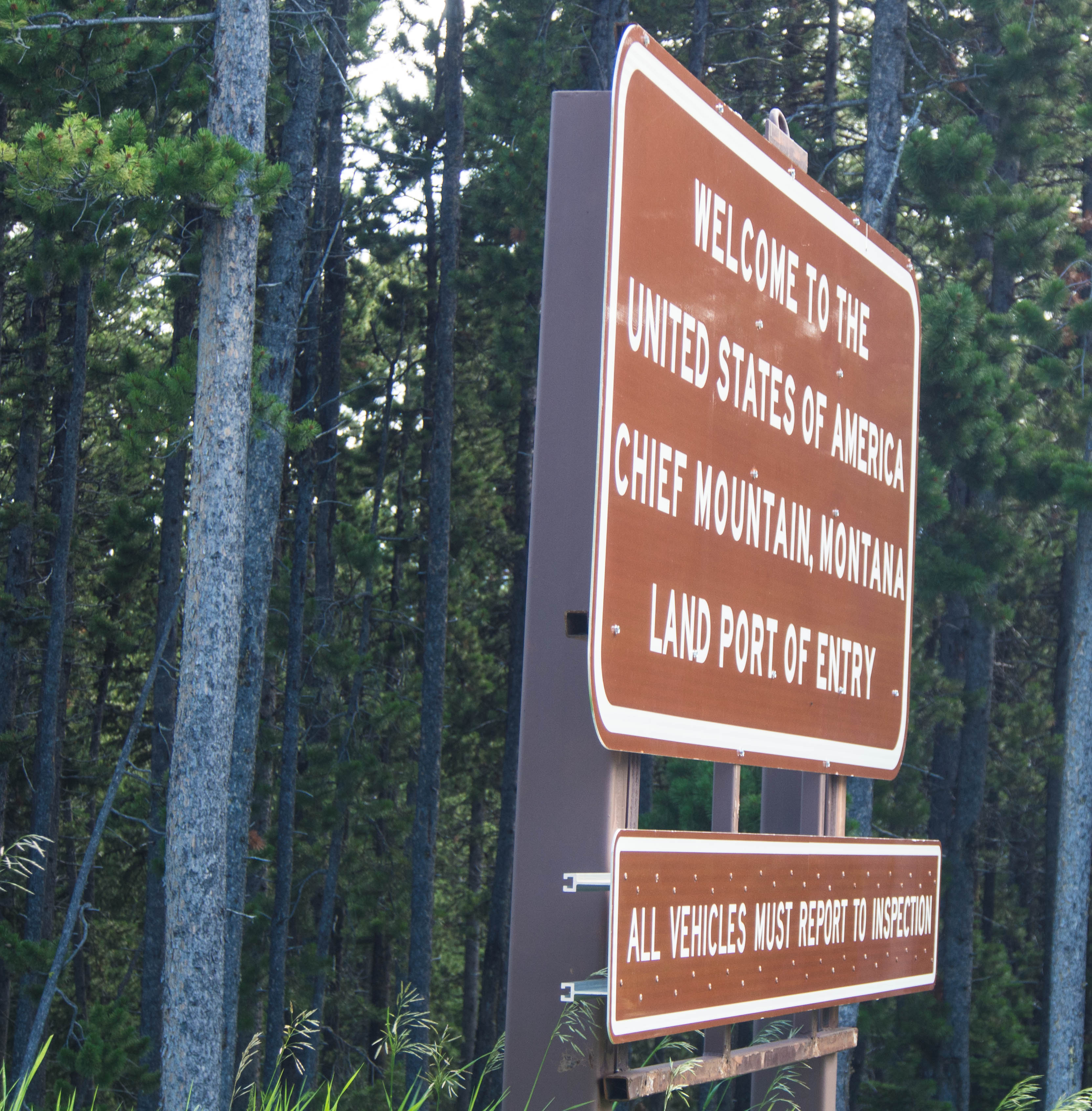
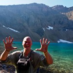
We quickly switched into Ed’s car and headed for the border.


Carthew 19

Chief Mountain Customs with Cartoon Filter


It always goes better if a nice car driven by a distinguished gentleman pulls up, instead of a bald, crackpot with a dirty dorm room for a vehicle.

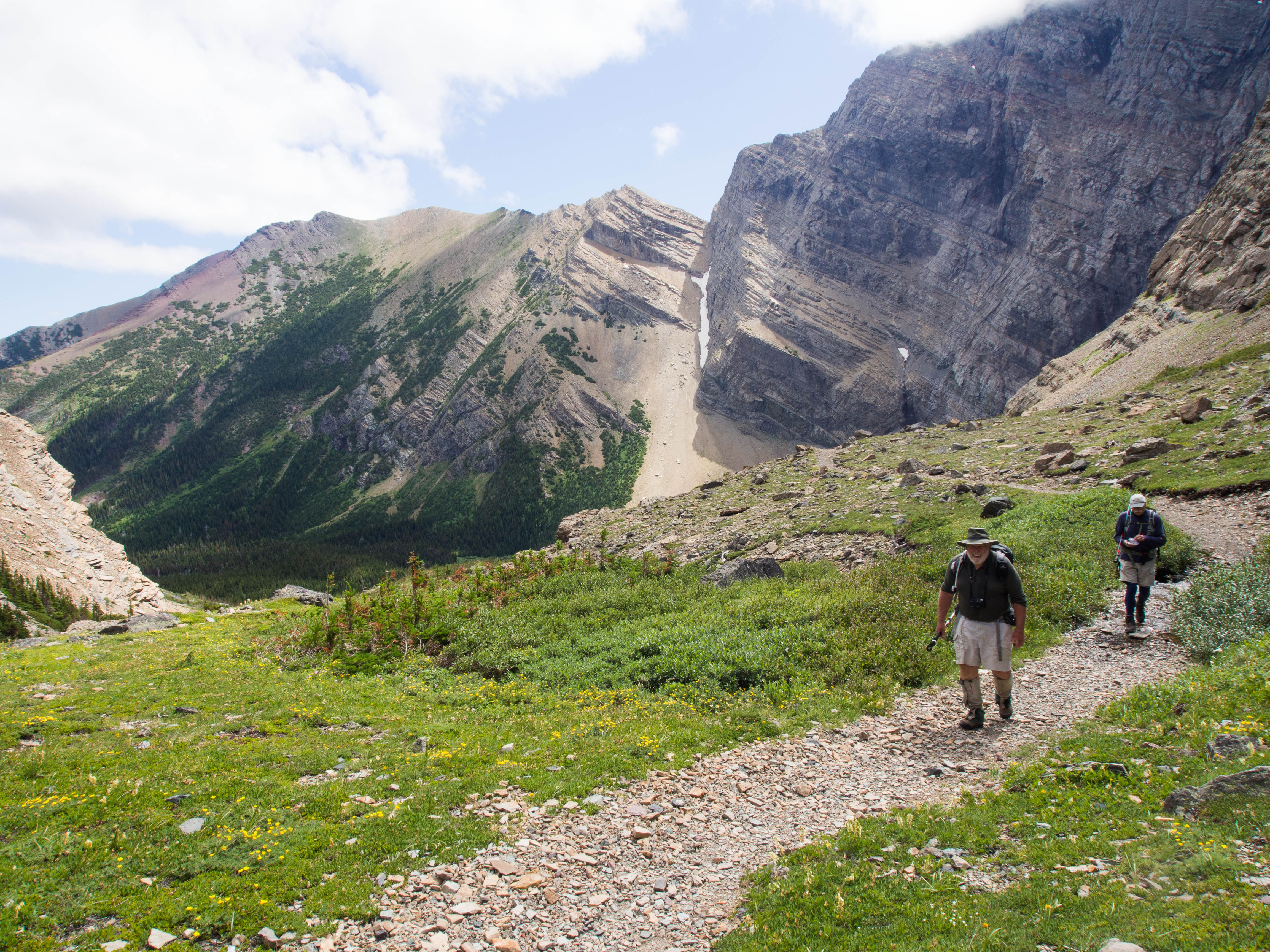
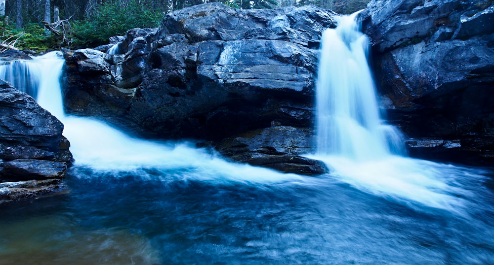
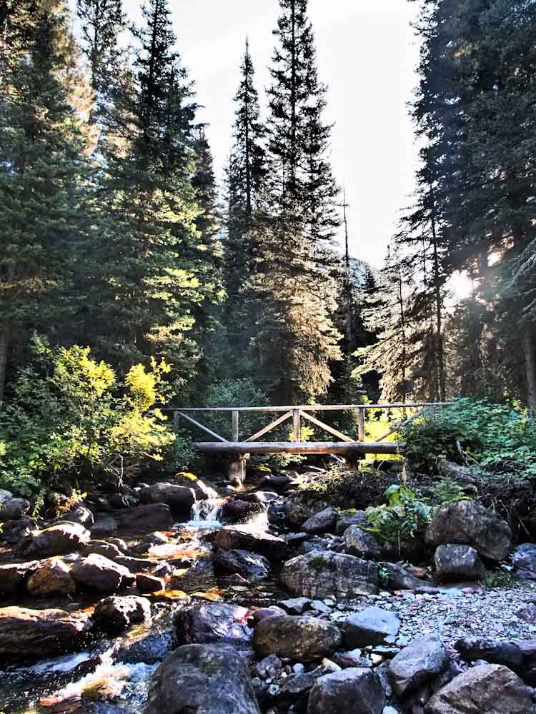
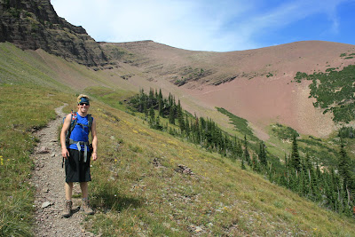
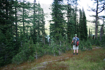
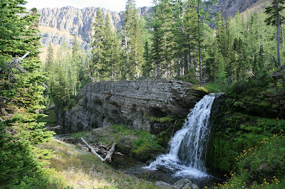
Everything went seamlessly and an hour later we were putting together backpacks and tightening trekking poles in the Cameron Falls parking lot.


Carthew 6

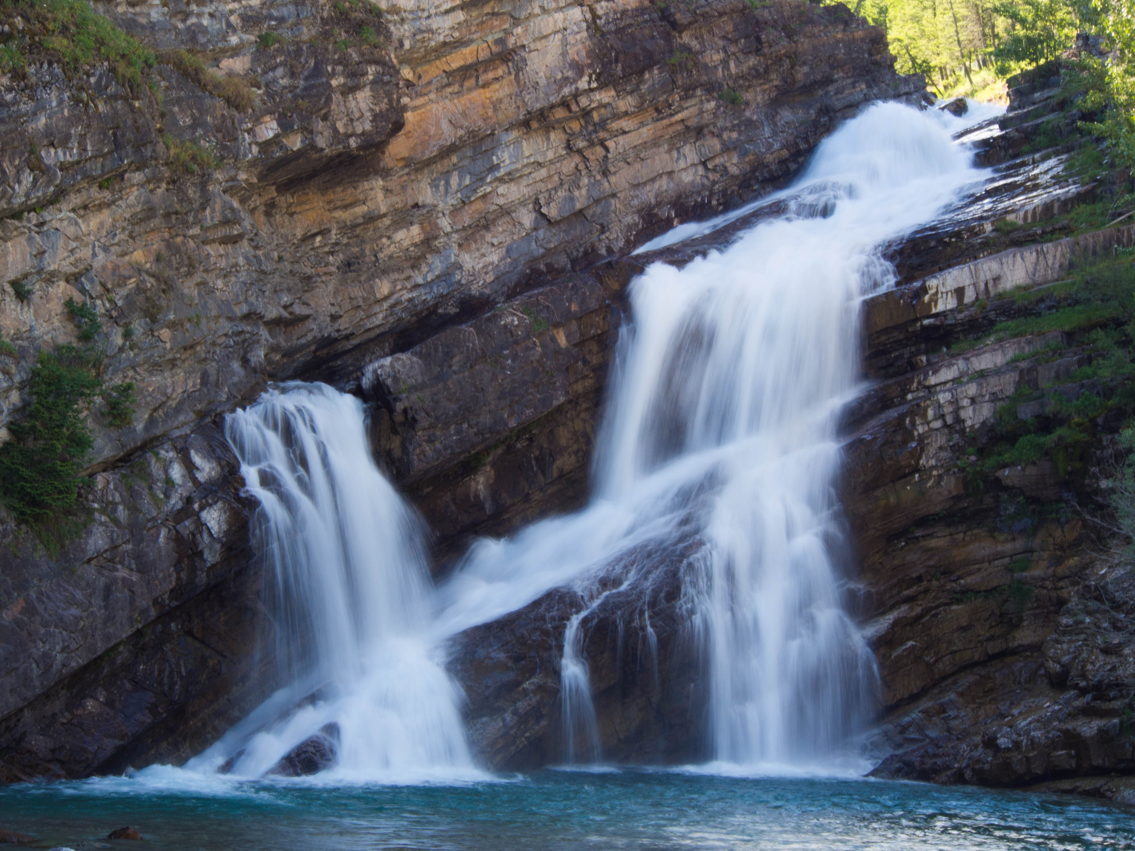
Cameron Falls, Wateton National Park


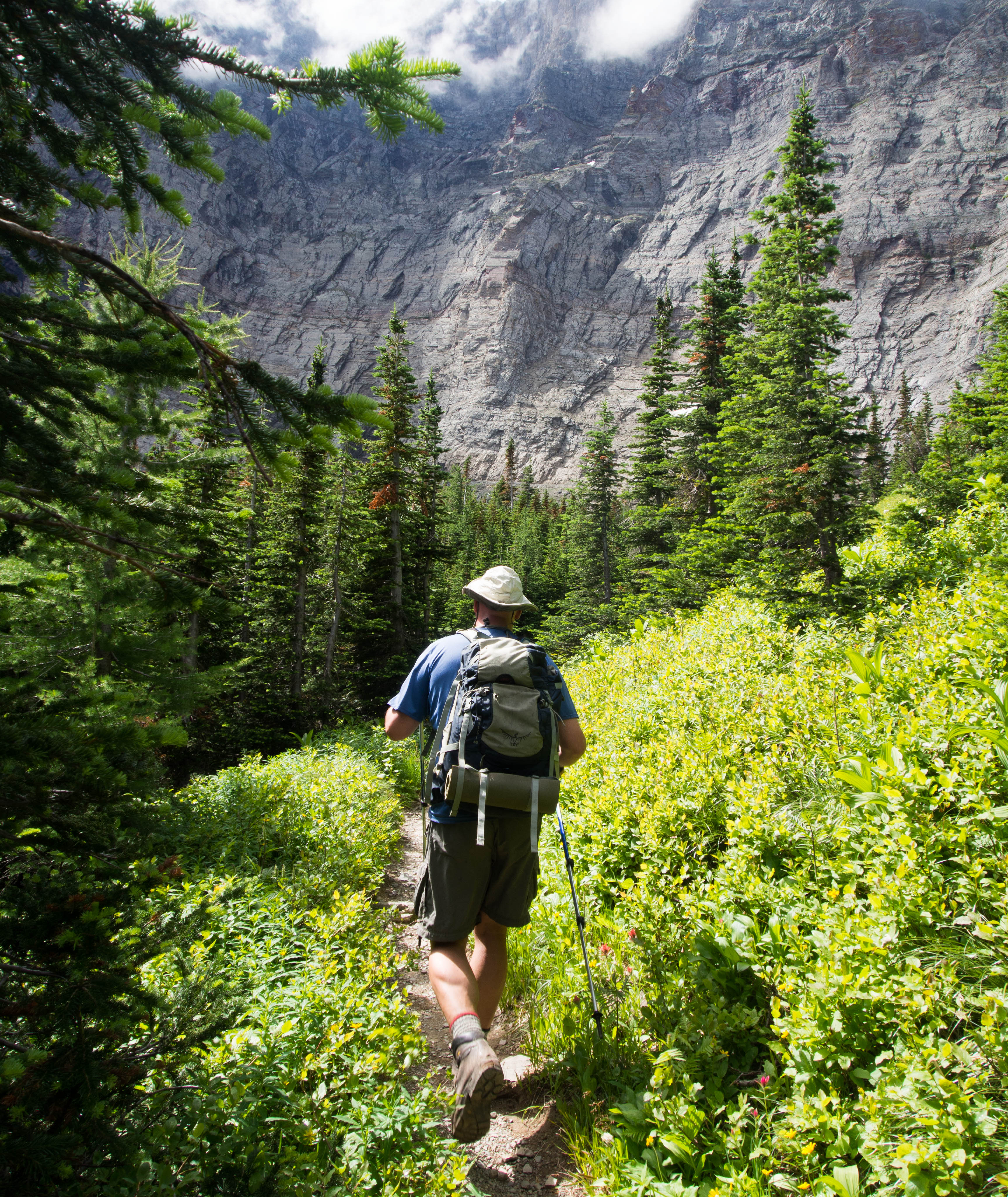
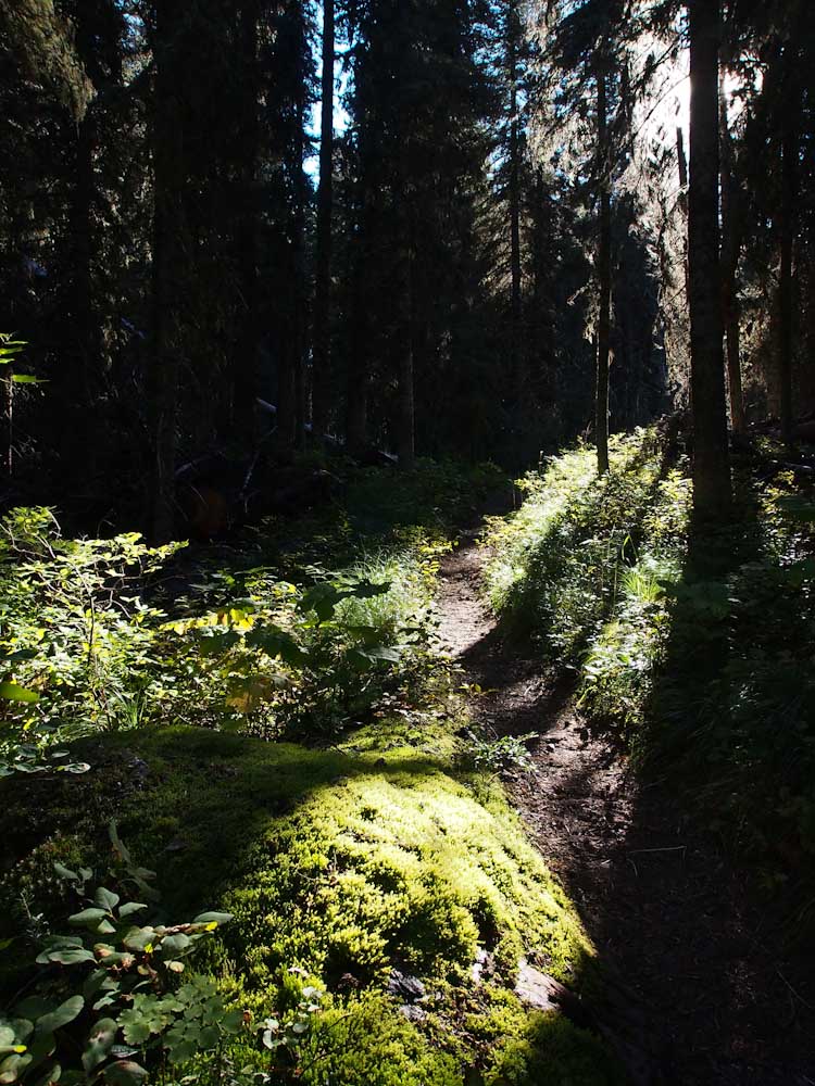
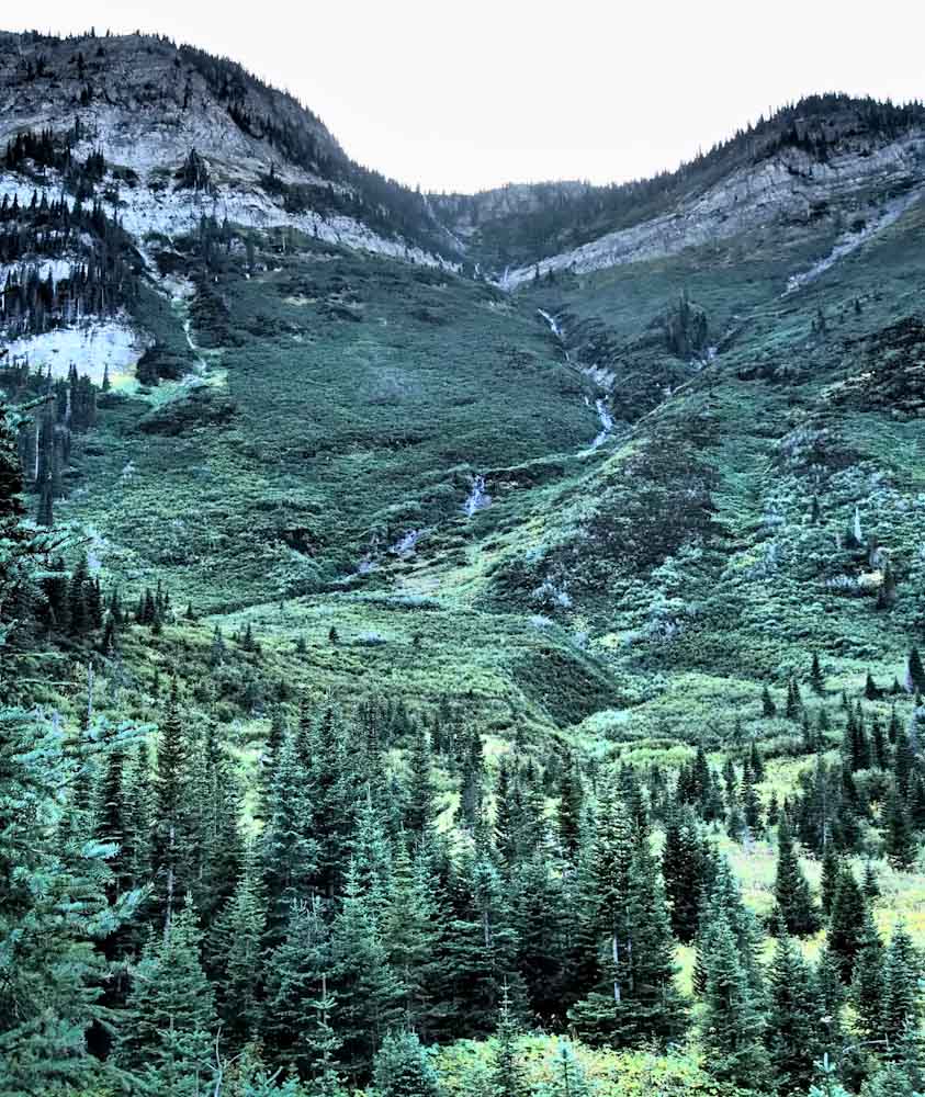
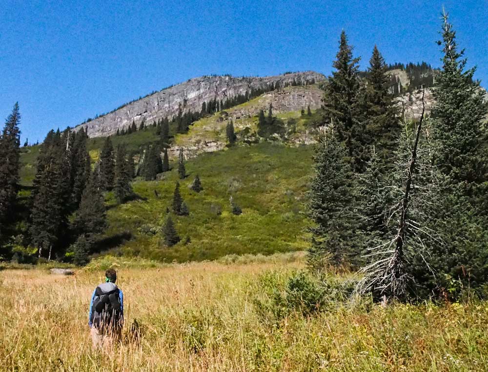
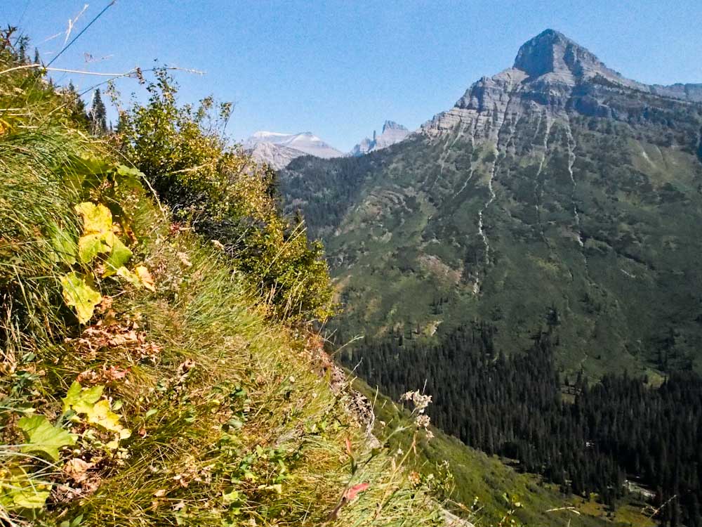
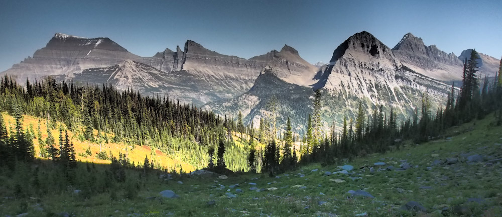
The shady, forested trail meandered uphill and felt like it would never end.


Carthew 7


An hour or so later we found ourselves popping out of the trees finally.

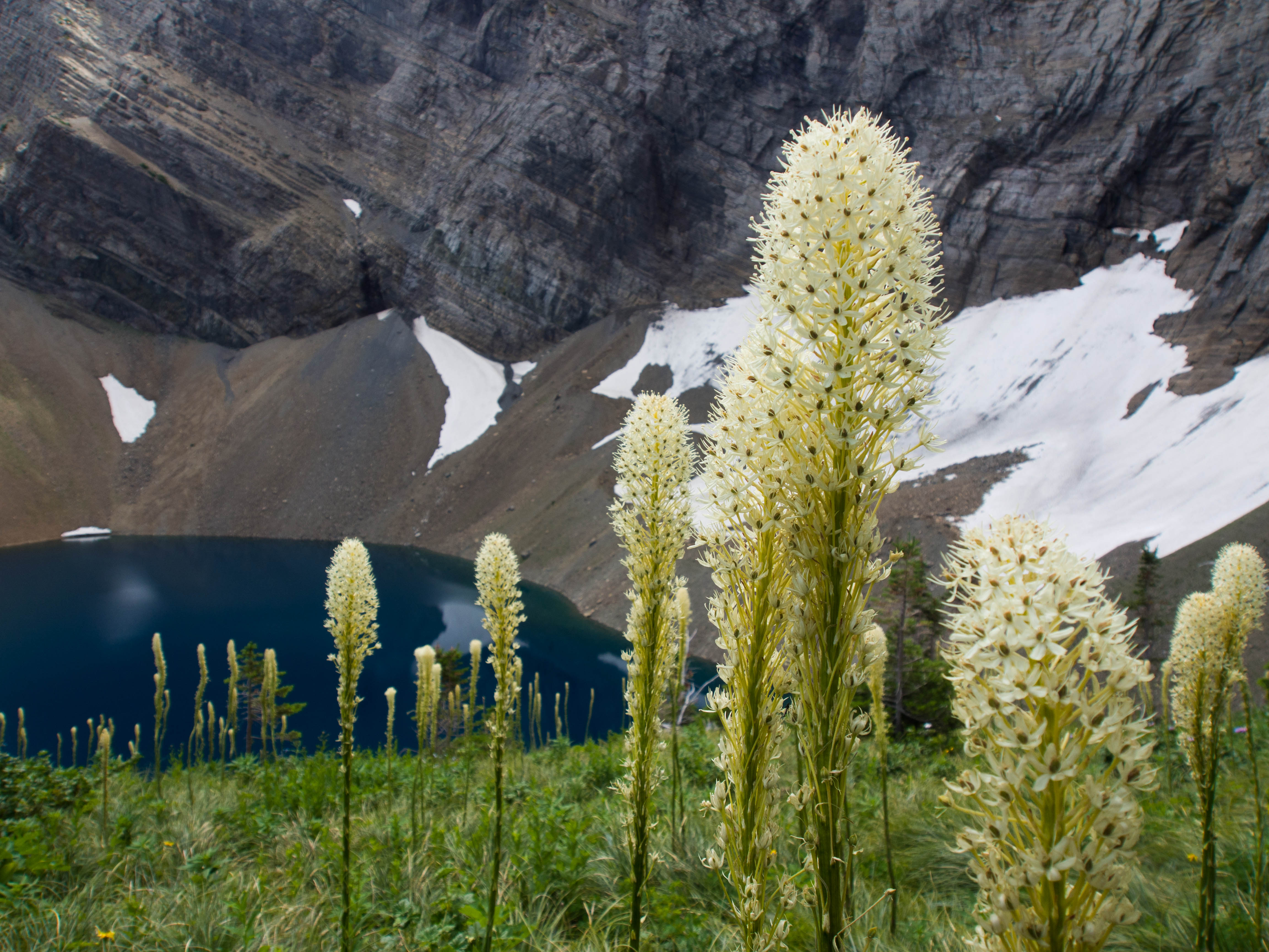
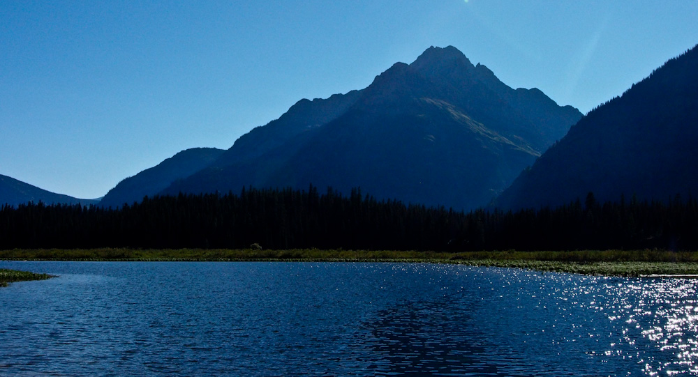
The massive headwall of Mt. Alderson dominated the scene.


Carthew 8


Alderson Lake’s deep blue contrasted against the meadows of vibrant bear grass.


Carthew 9


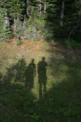
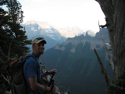
I have a different experience hiking with these fella’s than I do others.

We talk about life, philosophy, politics and just the prospective differences that 30 more years can provide.

I can’t tell you how much I appreciate the time that I get to bounce my life off of these two wise, pleasant men.


Carthew 10


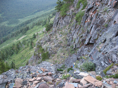
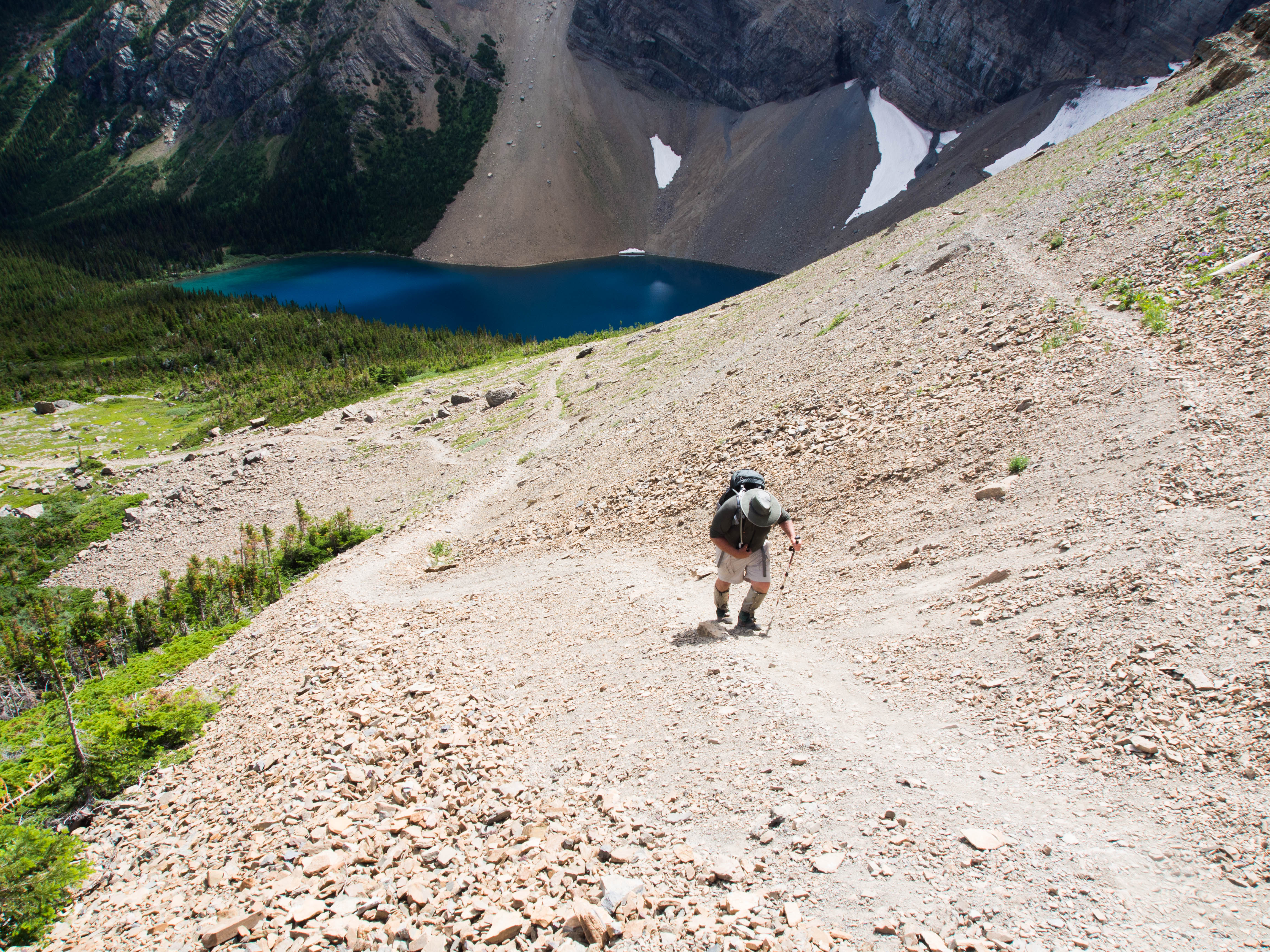
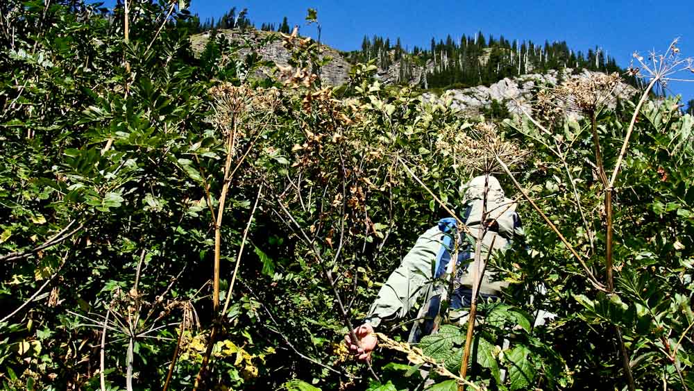
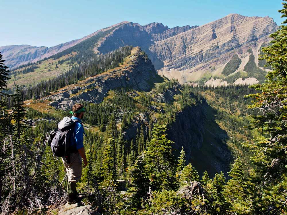
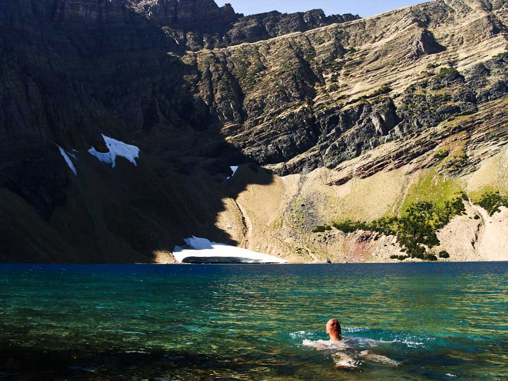
When Carthew Pond came into view we struck off through marsh ponds and stunted sub alpine trees.

The mosquitoes were enjoying the area as much as we were.

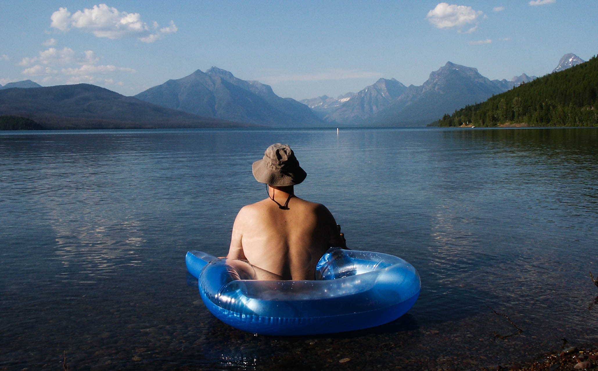
Thanks to our bug friends, like so often, we sped through the actual lake dip portion of the day.


Carthew 11


It’s funny; this whole thing is not about jumping in lakes.

It’s about the journey and experiences along the way.

The last decade for me was about the friends, the miles, the bushwhacks and the epic experiences in such a profoundly wild place.

Not, swimming.

That is just a medium.


Carthew 27


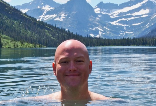
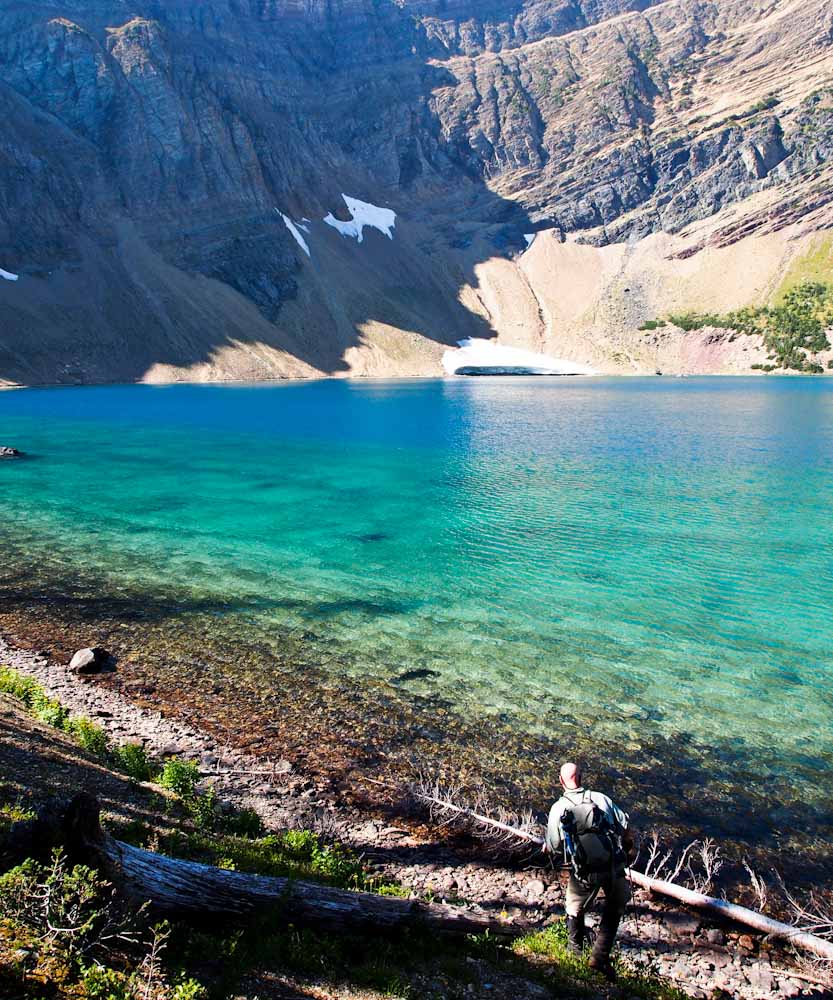
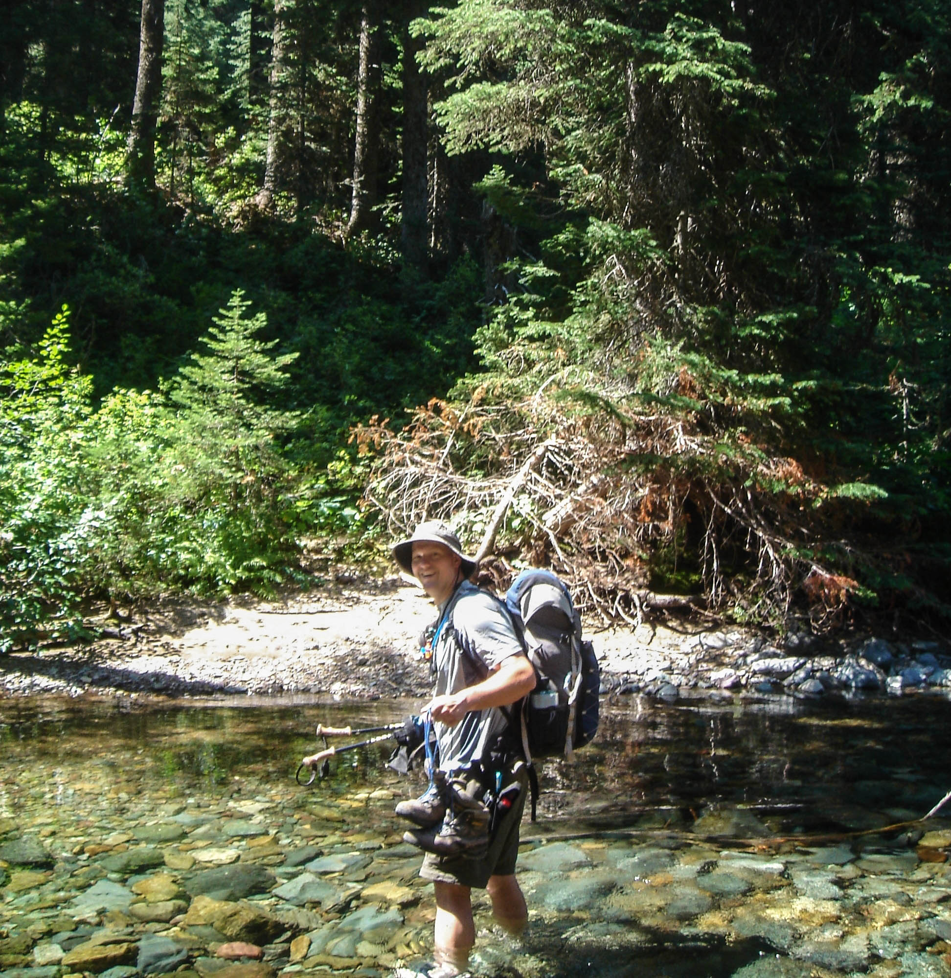
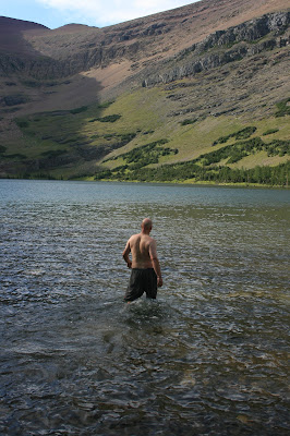
Ed waded into the lake with me to get some video as Dave photographed from shore.

Tiny little stunted fish swam around my torso as I floated in three feet of tepid water.


Carthew 12


I waded out to dry off as Ed took his own refreshing dip.

We were surrounded by amazing alpine scenery at this point and were not in any hurry to drop back into the woods or end the day.

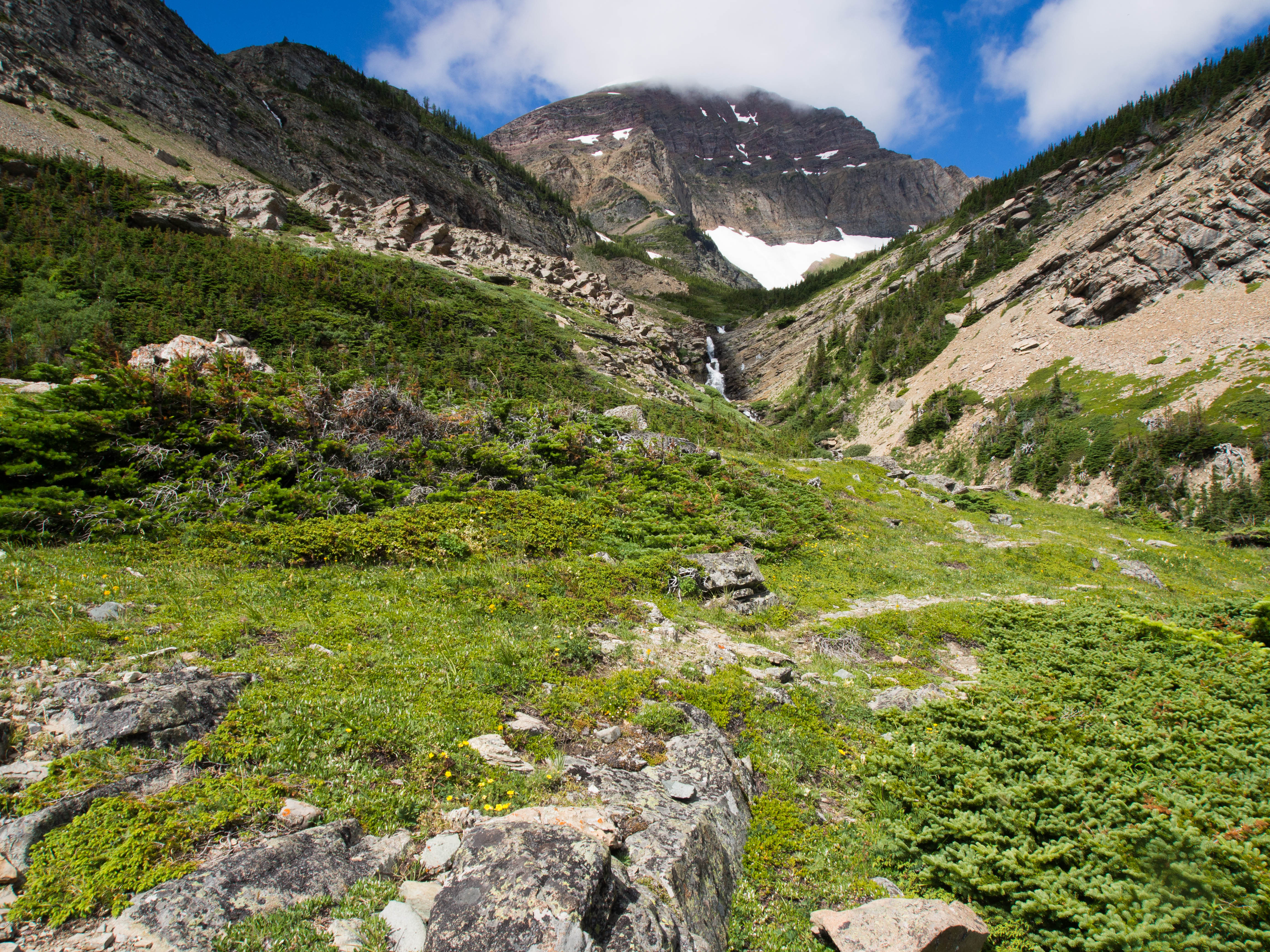
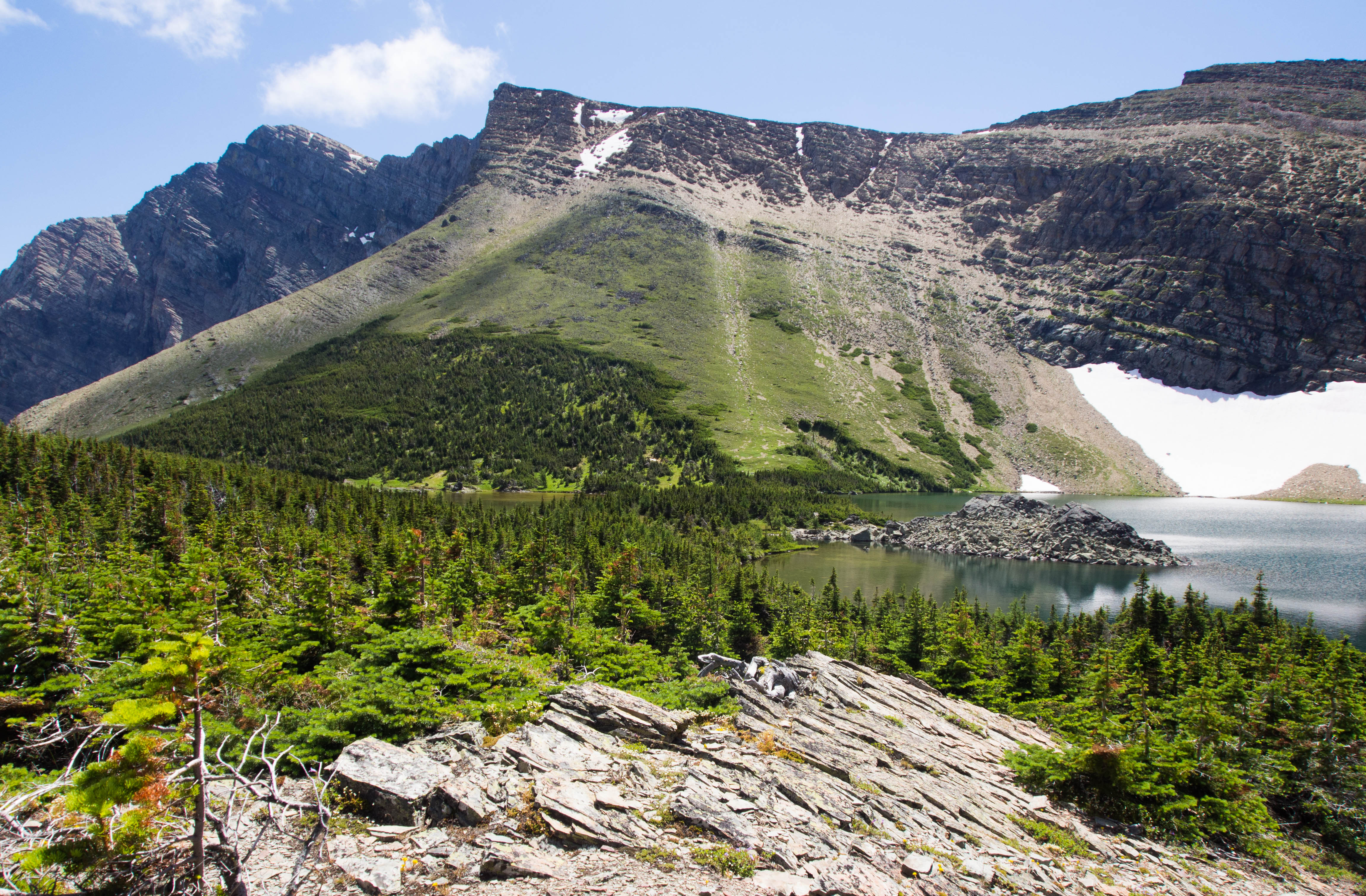
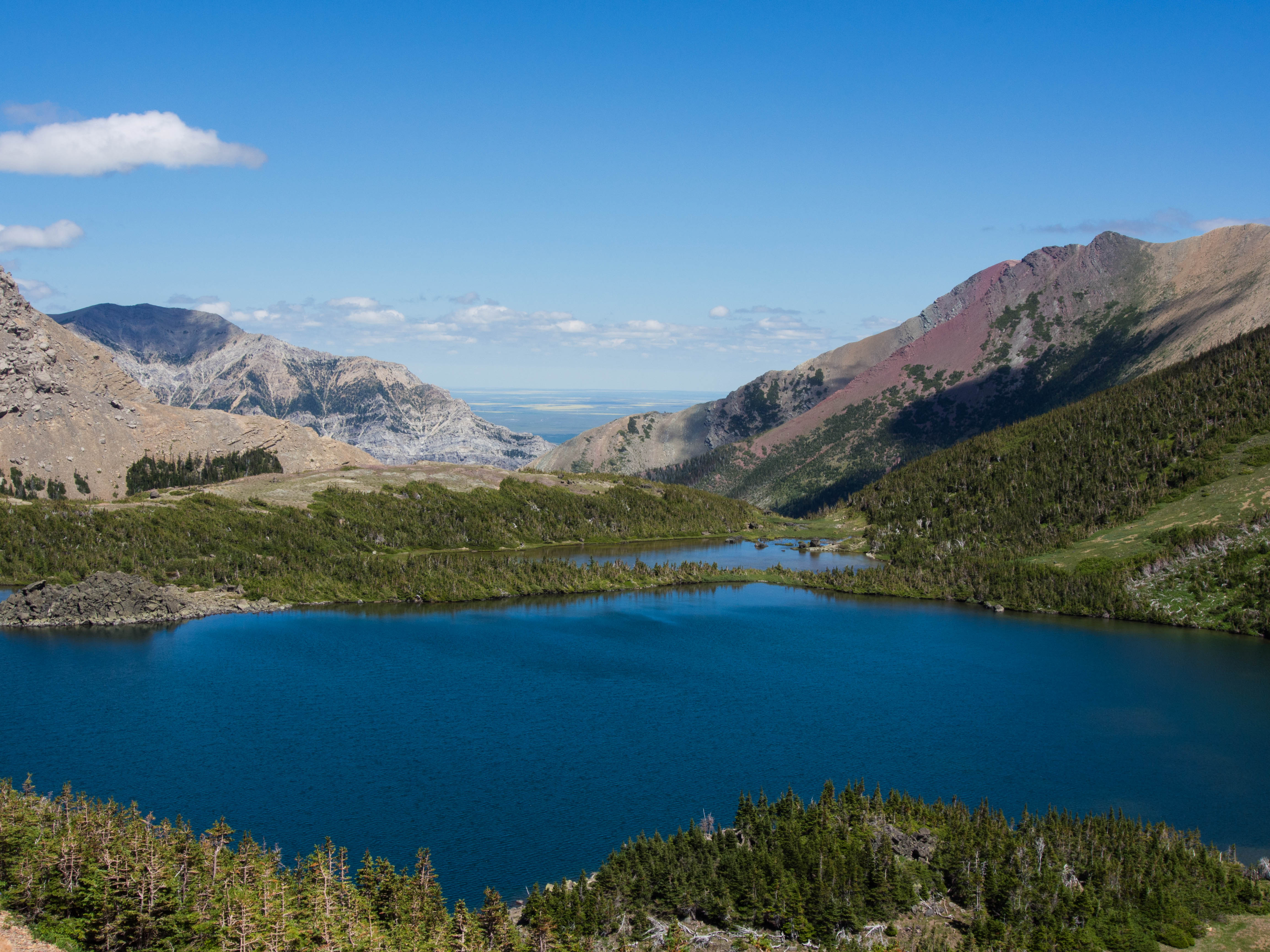
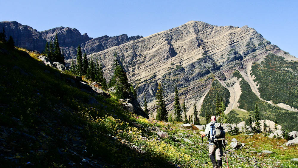
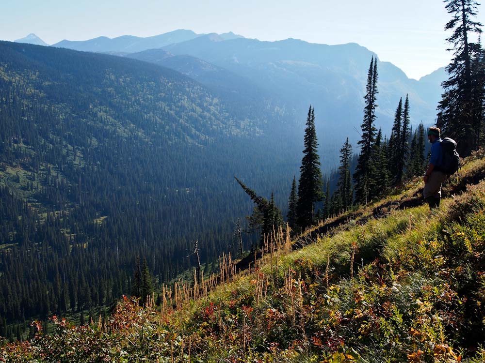
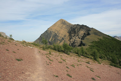
The trail continued uphill along the two Carthew Lakes.


Carthew 13


It would be foolish to not investigate.

Heck, for me it had been ten years, I was going to hang out for a bit.

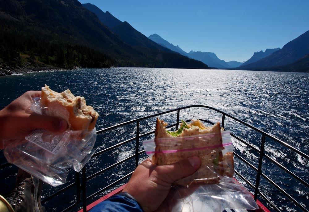
A flower choked waterfall area drained the Upper Carthew Lake which provided a stellar stopping point.

Water was filtered, sandwiches were eaten, jokes were told, and scenery was soaked in.


Carthew 14


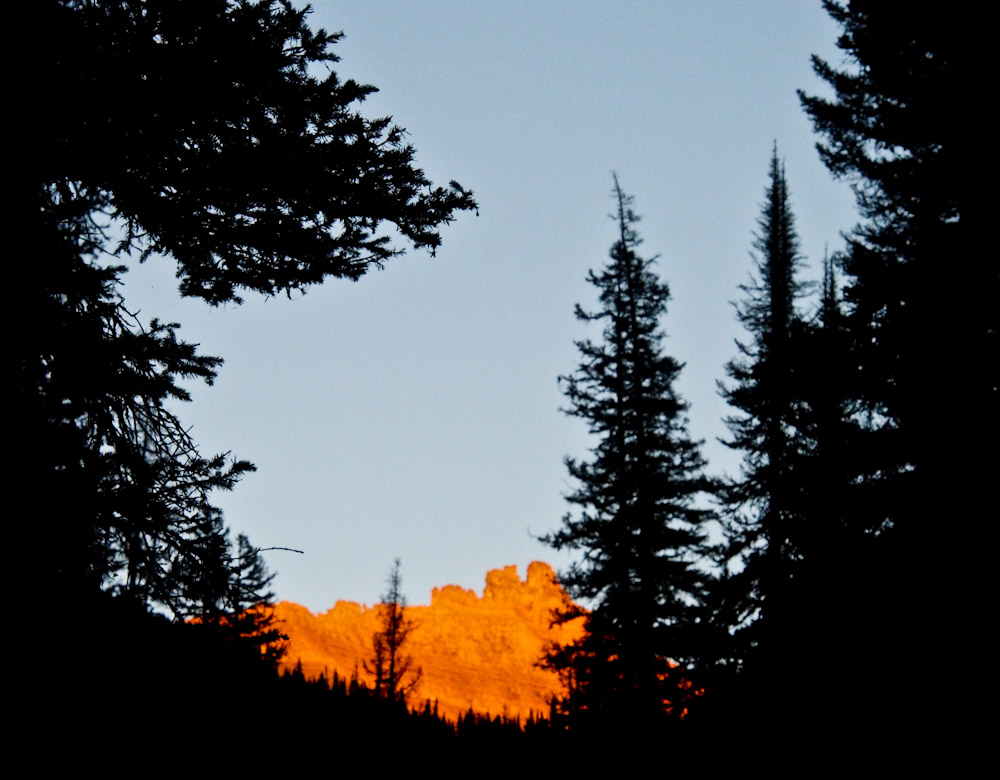
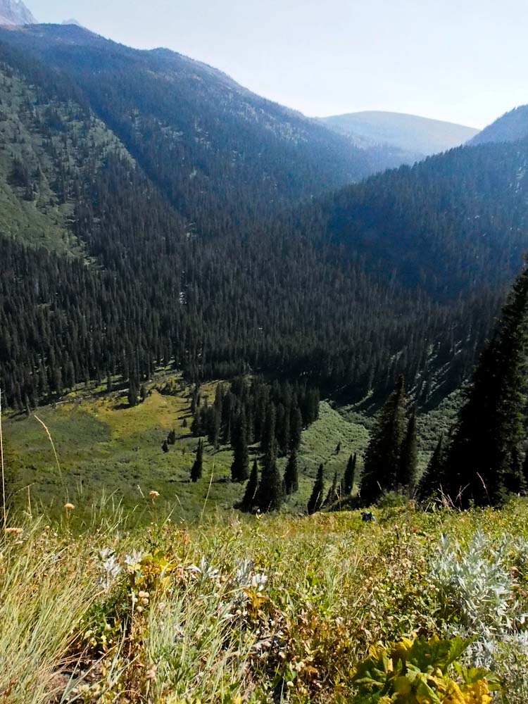
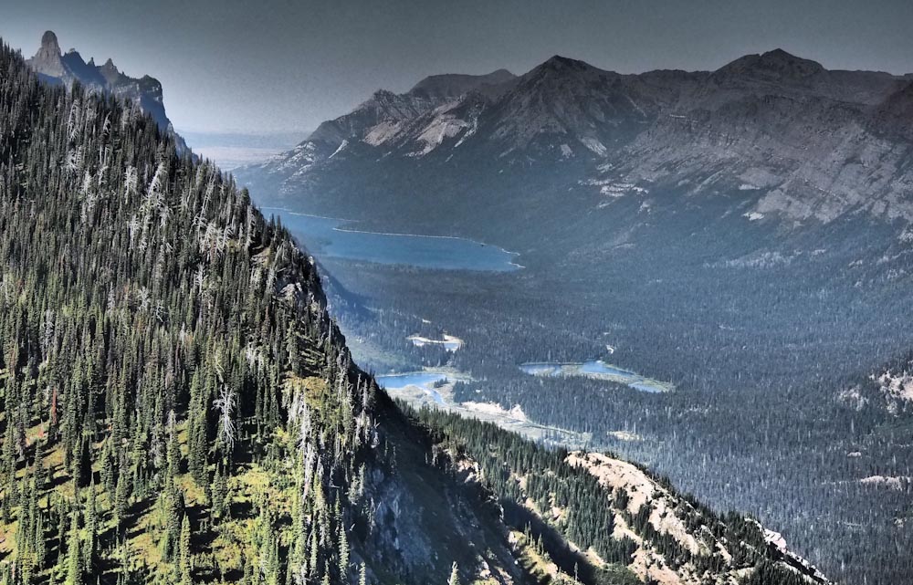
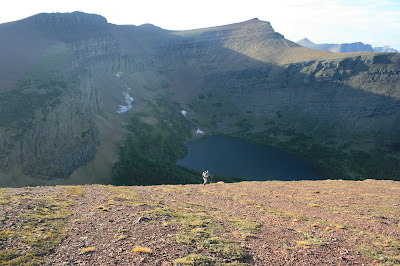
We stared down valley from a rocky outcropping.

Carthew Lake dwarfed Carthew Pond as the valley opened up like a mouth into the Eastern Alberta Plains.


OLYMPUS DIGITAL CAMERA


As we descended the trail we dropped through a snowfield which passed a strange little cavernous hole.

A baby marmot popped out to investigate the racket outside his tiny snowy home.

We only stayed a moment, so the marmots could have their peace and quiet.


http://www.youtube.com/watch?v=zJIwMprzy-I


We headed back into the forest and downward towards town.

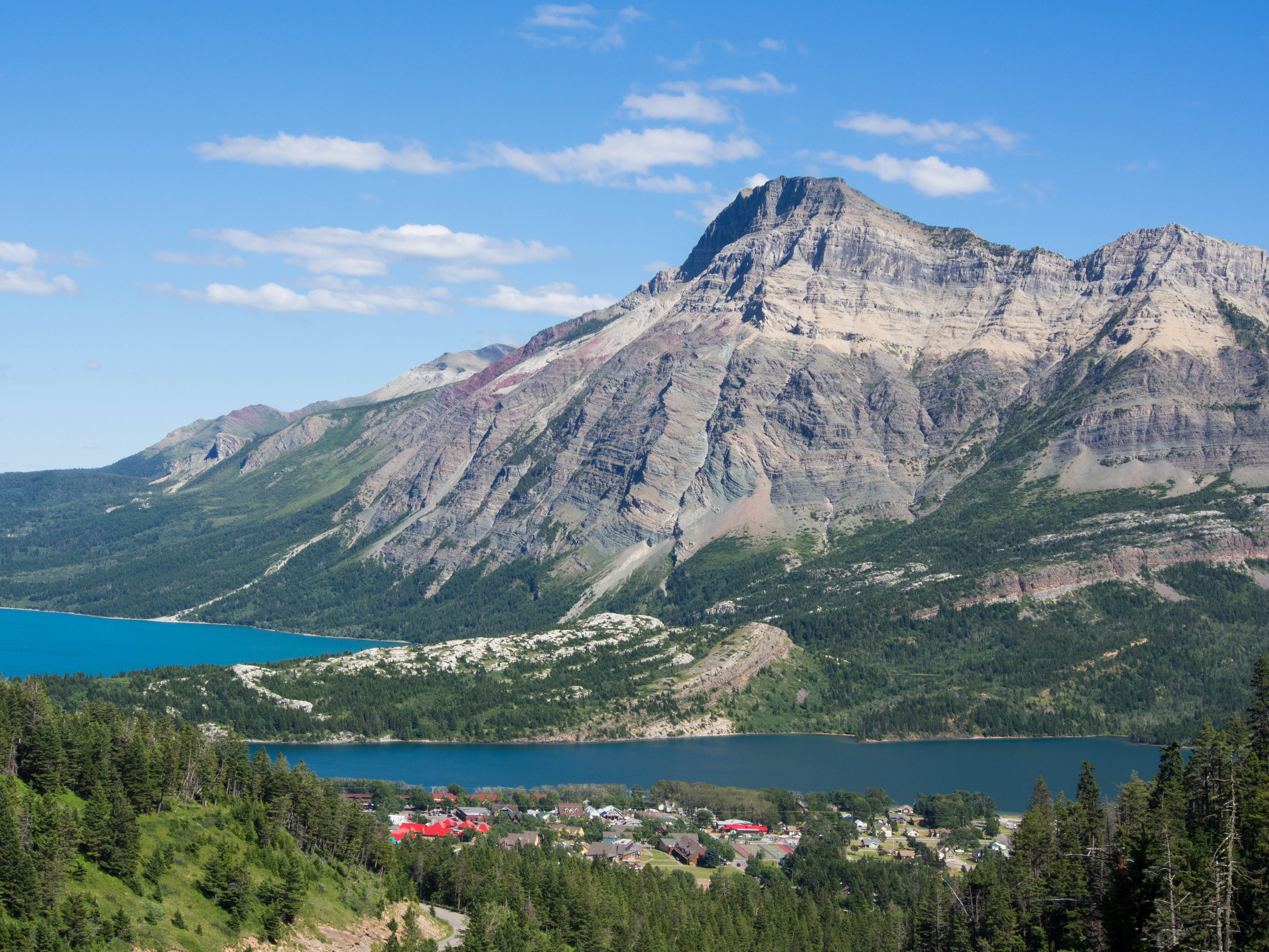
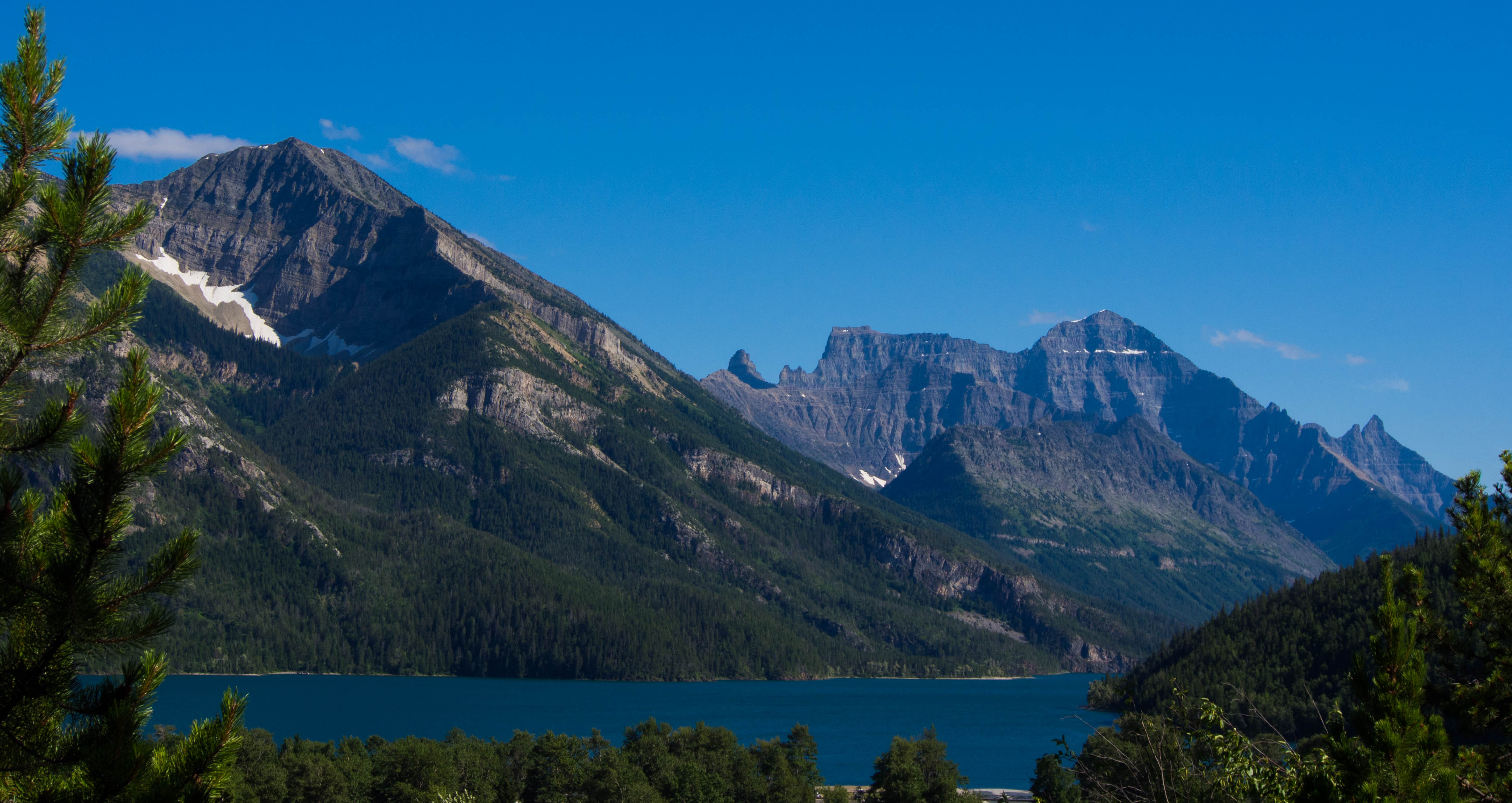
Waterton townsite is a colorful bugger from above, nestled in between the Waterton Lakes.


Carthew 16


We got a great view south beyond the border and back into the U.S.

Glacier National Park’s largest peak, Mt. Cleveland dominates the landscape above Waterton Lake.


Carthew 18


Tired, stinky but in good company we packed back in for our trip south across the border.

Thanks, Canada, for all of your lovely lakes, friendly folks and Toonie Coins.

But I’m heading back home for dinner, a cold beer and more good company.


Carthew 20


Great Day!

Thank, Ed and Dave.

For being so cool, loving this place and always being my friends.

To Life,

Marc Ankenbauer

Bench Lake-The Land of Alder: Ten Lakes Left!!!

NOTE: The Missoulian article that was written on March 11th, 2013 about the lake project stated that I have 10 lakes left, but up till now the website count still said 11 left.  Pat and I got Bench Lake done right before I left for Antarctica and I was never able to get the story posted before I was whisked away to the Great White South.  So, many months later…Here goes Bench Lake…

Bench Lake has been one of the “hardest lakes”  on my list since the inception of the project.

Since I never know exactly what these places will be like, I can only guess at any point on which is “the hardest lake left”.

The “crux” has ebbed and flowed as I checked off lakes, although Bench has stood atop this list for some time.

While this lake was physically very difficult, the logistics made it even harder.

Before our feet even hit trail we had to travel hours and cross two border crossings, one by car and one by boat.

The trip begins by driving to Waterton National Park in Canada.

From there we took a tour boat down Waterton Lake to a place called Goat Haunt which is back in the United States.

OLYMPUS DIGITAL CAMERA


My good friend Keith works on the MV International.

It is the Waterton Shoreline Cruise Company’s pride and joy tour boat.

This historical wooden vessel is 85 years old.

There is no classier way to enter the United States.


Halfway down lake, the boat crosses the U.S./Canada border which is designated by the border swath.

OLYMPUS DIGITAL CAMERA


This is a 100 foot wide clearing that runs the length of the border from Atlantic to Pacific.

Trail crew clears it every few years to keep Mother Nature at bay.


Pat and I have entertained making a website entitled “where I ate my lunch”.

This photo was taken as we enjoyed the most lovely border crossing in the world.

We even had chips…  Two kinds…


OLYMPUS DIGITAL CAMERA

At the southern end of the lake, U.S. Park Rangers and Customs Officials were there to welcome us back into the United States.

They are only welcoming between 11AM and 5PM though,  and don’t forget your passport if you want to enter!

The tiny Ranger Station is referred to as Goat Haunt.

The custom goat weather vane makes it very clear where you have landed.


OLYMPUS DIGITAL CAMERA

I had forgotten my trekking poles and the kind Park Ranger allowed me to use a mismatched pair they had in the corner.

Thanks Nice Park Ranger!!

Before we left Goat Haunt, Pat and I stopped by and saw the horse corral.

Pat is neither this small nor is this horse this big.  I swear.


OLYMPUS DIGITAL CAMERA

Goat Haunt is the northern terminus of the Continental Divide Trail which leads from Mexico to Canada.

The trail head sign leading south shows the official CDT emblem.


OLYMPUS DIGITAL CAMERA

We happened upon a few very excited CDT hikers who were only miles from completing the journey of a lifetime.

Congratulations on your accomplishment folks!

I’ll raise my glass while you put your feet up.


OLYMPUS DIGITAL CAMERA

The trail meanders up valley through some of the thickest forest in the park.

Glacier National Park is the wettest part of the entire continental divide and the thick undergrowth and forest in the area show it.

Tomorrow’s objective is tucked into the side of Kootenai Peak.


The waterfalls draining Bench Lake become the Waterton River 3000’ below.


OLYMPUS DIGITAL CAMERA

It pools a bit to form Kootenai Lake and then rolls onward into Canada and beyond.


OLYMPUS DIGITAL CAMERA

Night fell as we pondered the tomorrow’s logistics.  Fingers Crossed!


OLYMPUS DIGITAL CAMERA

A cold but clear morning met us as we hit the trail early.

The bridge crossing Pass Creek made a nice spot to have a snack.


OLYMPUS DIGITAL CAMERA

Eventually we struck off into the head high brush instead of continuing on-trail towards Fifty Mountain backcountry campground.

From here, we are talking thick, thick vegetation!

I’ve had conversations with researchers who agree that Goat Haunt vegetation is the thickest they have ever experienced.

Pat and I found an opening to survey our route options.

The direct frontal attack toward the lake looked horrendous.


OLYMPUS DIGITAL CAMERA

We knew any route would be bad, but this looked worse than necessary so we continued up river.

We headed down a dry creek bed that would have been fine for a garden gnome.

Anything that would get us a moment of reprieve from plant material.


OLYMPUS DIGITAL CAMERA


The dry creek bed led us to the Waterton River and a very manageable late season crossing.

OLYMPUS DIGITAL CAMERA


The river and all the waterfall chutes we need to work through would be terrible with higher water.

After crossing we dried our feet, put our boots back on and ate a little snack.

We stood in a meadow staring at what would prove to be the worst part of the whole trip.


OLYMPUS DIGITAL CAMERA

We had a couple thousand feet of what I guess to have been 50 degree angle alder slope.

We literally had to pull ourselves up branch by branch as we were swallowed on all sides by plants.


Bench 16


The limbs were interwoven so tightly we literally had to undo the weave to push through.

We had to watch what we were grabbing because the ground cover was made of devils club and strawberries.

Strawberries sound innocent enough but they are covered in awful little needles.

Devils Club is aptly named; it’s the worst stuff around.

So if ripping and thrashing up this insane slope of crap wasn’t bad enough we had thorns everywhere.

Bench 17


To make things worse, when we finally punched out of the alder we ended up in a steep, wet cliff band.

This is where Pat steps up in like Superman.

Although he has taken to wallowing around in plant material, bushwhacking has always been more my bag.

He’s a confident mountain goat and has “talked” me through some pretty hairy moments.


I picked lakes for a reason folks.  I’m not great with climbing.

Thanks man.  I owe you big time.

How about a tall Rouge Voodoo Donuts Bacon Maple beer and a cigar?   Deal!


OLYMPUS DIGITAL CAMERA


The slope above the cliffs was insanely steep and we had to bear crawl our way up.

Anyone out there that played football, remember bear crawls?

Now try them with a freaky cliff below you on a slope of hard pack dirt and scrubby plant material.

I was grabbing tiny plants and hoping they held as I tried to just keep my feet moving.


OLYMPUS DIGITAL CAMERA


Eventually we popped out on the ridge and things calmed down a bit.

Hoping for a view of the lake we plodded through off angle bear grass and intermittent cliffs.


OLYMPUS DIGITAL CAMERA


From the top of the ridge we realized that we still had plenty left.

The lake is tucked at the bottom of the main headwall of Kootenai Peak.

Envision that the lake is in the bottom of the pocket of a molar tooth.


Bench 21


We knew light was going to start becoming an issue so we double timed it to the lake.

Eventually we were greeted by profoundly beautiful turquoise water.


OLYMPUS DIGITAL CAMERA

In a rush we both mowed our lunches.

Pat pumped a bunch of water as I got ready to hop in.  .

The lake felt great and helped get the seeds and debris out of my ears.


Seriously though, this was monumental for me.

At the time we were focused on the situation at hand.

But,  I’d been waiting for this moment for a long while.

Bench 23


This was BENCH LAKE!!!  My long time arch nemesis!

This thing had been staring me in the face for years.

As I knocked off other members of the “Top 20 List”, or wallowed into other lakes in the Goat Haunt jungle, I was always waiting for this moment.

Plus, I now had 10 lakes left.


OLYMPUS DIGITAL CAMERA


What a great number.

Ten.

How simple and straight forward.

I had ten left.

Not, 67 or 93, or 126 and certainly not 168.

But, 10.

High Five, Bench Lake!


But, now we had to get back before nightfall hits the alder thicket.

We will celebrate later.

The lighting got more and more amazing as it got later than it should be.

We stared off from an odd vantage point in which most never see.

We looked directly across at the parks high point, Mt. Cleveland.  All 10,461 feet of it.

Next to it stood Stoney Indian, Cathedral and Wacheechee Peak all surrounding Stoney Indian Pass

OLYMPUS DIGITAL CAMERA


We gazed North into Canada past the Porcupine Spires, Kootenai Lakes and Waterton Lake.


OLYMPUS DIGITAL CAMERA


I saw the tour boat leaving Goat Haunt which meant it was 5:30.

And it was not getting any earlier.

As we cruised south along the ridge we stared off at the mountains that shadow the northern Highline trail.


OLYMPUS DIGITAL CAMERA


To the West was the remote upper Waterton Valley with Nahsukin Lake, Vulture Peak and the rest of the Livingston Range.


OLYMPUS DIGITAL CAMERA


Keep Moving!

Down a steep rocky chute to gain the correct exit ramp.

Keep Moving!

Try to stay upright sliding down slopes of uneven bear grass.


OLYMPUS DIGITAL CAMERA


We walked the ridge further south so we could bypass those blasted cliffs.

Keep Moving!

Back into the thickest alder on earth.


Bench 30


We weren’t even touching the ground at a lot of times.

Keep Moving!

Two daffy goof balls yelling “Hey Bear” and laughing in that not totally there kinda way.


In the end our pants looked like we did battle.

A Vegi battle.

A Waterton River Vegi Battle.


OLYMPUS DIGITAL CAMERA


Once we hit Waterton River we knew we were going to be alright.

We moved happily back towards camp which was still miles away.

We weren’t in alders anymore and that’s all that mattered.

I would like to thank Waterton Valley for safe passage.

She allowed this to happen and I’m forever grateful.


OLYMPUS DIGITAL CAMERA


I still can’t believe that I’ve only got 10 left.

I’ve been waiting for this moment for such a long time.

This project may seem goofy to some of you.

And, while that may be true…

It has taken a whole lot of dedicated, sweaty and painful Goofy to get to this point.

Most of all, Thanks be to Pat.

I couldn’t have done this without you.

You’re the man!!

Now let’s revisit that horse picture.


OLYMPUS DIGITAL CAMERA

To Life!!!


We Met Our Original Goal of $5000!!! Thank You!!!

THANK YOU!    THANK YOU!!  THANK YOU!!!

GIVE YOURSELF A ROUND OF APPLAUSE!!!


Ten years ago I decided to undertake what will prove to be the most time-consuming, physically exhausting and kinda bizarre endeavor I’ll ever participate in.

I wanted to try to be the first person to “Jump in Every Named Lake in Glacier and Waterton National Parks.”

pics for journalist (3 of 4)

There was something missing though.

Summer would arrive and my friends and I would roam some of the wildest and most remote corners of the Northern Rocky mountains.

But I wanted it to mean more.


Then I learned about a camp that gives kids affected by cancer a unique and medically supervised Montana experience.

It just seemed right.

You know?

In my opinion, life is all about experiences.

So, whats better than helping to create a few for some kids that could certainly use them?


I needed YOUR HELP though.

And Wow, did you deliver!

DCF 1.0

We just met our original goal of $5000!

A HUGE round of applause for everyone that made this happen!

We’ve not only met the original goal, but we quickly passed it!


It’s March now.

I won’t be finishing up the last 10 lakes till late summer.

LET’S SEE HOW FAR WE CAN TAKE THIS THING!!

OLYMPUS DIGITAL CAMERA

I’ll keep more stories and photography coming.

Tales from the lake project, Antarctica and whatever else I think you might like.

I hope you have enjoyed what I’ve put out so far.

I certainly enjoy doing it.


And Again, I want to THANK YOU all so much for making this project a fundraising success.

You are ALL A BUNCH OF ROCKSTARS!!


Kessler Lake – Right on the Edge – CAN

Kessler Lake Fence PicHi there every body!
I’m here to tell you about Kessler Lake, Ed, Diane, Jenny and a galloping  black bear.
Now, you see.
 Purple Flower
Ed went with me to Crypt Pond in Waterton last year.  However, this was the first lake outting for his wife Diane and our friend Jenny.
Actually I had never hiked with Diane before now, and she’s  a rock star.
Mt. Dungarven

June has been cold, rainy and even snow off and on.

So, this was a great day by just being alright… Clouds were threatening but luckily that just added cool clouds.

Kessler Lake is at the base of the Eastern Front which is literally where the plains hit the mountains.

Plant and Clouds

To the west of the Rocky Mountains are hundreds of miles of rolling mountains all the way to the coast.  For the most part…

However when you go east of the park its open plains till you hit Chicago.

The plains get better weather and since Kessler is right on the edge we got a pretty fair shake on weather.

Cows Running

We drove up to Canada in the morning and found a road just north of the park.

The Easment Pathway

It lead in to private property but there is a right of way through the cow fields to the boundary of the park.

Cows and Mountain

There we met up with the barbed wire fence that marks the boundary and had to climb under it.

Fence Line Waterton Border


From here there was basically a trail leading along the fence line which we followed directly towards the Mt. Dungarven and Mt. Galway.

Ed and Mt. Dungarven


Along the way we had to schwack around marshy impoundments and over little grassy rises.

Kessler 10


Kessler 11

The lake was well larger than I envisioned.

Kessler 12

It was very shallow through.

Kessler 13

When I did finally get in I had to basically just lay down out in the lake.

Kessler 14

Not much swimming going on.


When we first got to the lake, I had to sift through camera gear and we all ate lunch.

There is fencing that goes all the way to the edges of the lake as its half in the the park and half out.  I planned to make my way inside the park boundary.  So, I would be official, you know…

Kessler 15

We were about to head to the fence and out comes a black bear right where we were going to jump in.

He walked to the lake, swam in and right back out.  He shook off his coat like a dog and started bounding back up the little rise and out of sight.

The clouds all day were crazy.  The dramatic filter on my camera was able to get some pretty great shots.

Kessler 16

Kessler Lake


It was nice to have a so many people along.

I haven’t gone to a lake with four people in a while.

Kessler 17

Aside from great company, I had a mini film crew.

Ed took my GO PRO HERO 2 and walked out in the lake to film.

Diane took photos with their camera for evidence.

Kessler 19

Jenny staffed my new Olympus OMD EM5 and got video.

You three are awesome!   I really appreciate it.

Kessler 20

We eventually headed our way back to our car and drove back into the states.

Kessler 21

Chief Mountain Customs Station

Great day!

Even enjoyed a great dinner with friends and a good Ranger IPA.

 Kessler 22

Upper Rowe and Linham Lakes – Where’s that goat trail? – CAN

This is a story about last summer. I never got a chance to create a blog for this until now. So, hope you enjoy a backlogged lake blog (say that ten times)…..until I get something new for the year. Hope to a new lake before the end of May. Stay Tuned

So the story goes……………

Tradition has it that once, and it seems to be only once a year my friend Kieth and I go for a hike. He works for the boat company in Waterton and we tend to have contrasting schedules all summer. 
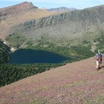
We were able to keep tradition going once again with an awesome day in late August.We completed a feat that I have only had success with once before. We got five lakes in one day. It takes putting a large effort in, but more so it takes a cluster of lakes to be able to pull that off.
This project is about the lakes and the park, well more than my or anyone else’s efforts. If they want to allow things to progress. then I progress.If not, then we kindly say thanks and slowly plod along to one lake at a time…. If you’re lucky.So luckily the upper Rowe Lakes and the Linham Lakes are in general vicinity of each other in the middle of Waterton National Park.We headed off pretty late in the day. I bet we did not hit trail till about 11:30 or noon. We had lots to do in a short amount of time. Up the Rowe valley till the Upper Rowe Lakes trail took a big, uphill left turn. I had done the single lower Rowe Lake last year, so to acquire the top two was a great hit for me.We found a little bay behind a rock to take a dip because the wind was kickin hard. After it we walked the outlet creek to the middle lake. 
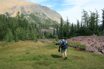
What a lovely day for a bunch of dips. This would have been a brutal one if it were nasty weather. Five lakes would get terribly chilly going at it in the rain.There is a nice goat trail that connects the Upper Rowe lakes trail with the upper reaches of the Rowe valley trail. It was nice because we did not have to drop that whole way back into the valley bottom.

We had to push up to Linham ridge and find a spot to hop over the other side of it. We envisioned that we just had to get to the prominent saddle and head down from there.

When we finished the huge uphill slog we got up to that saddle and there was a 2000 foot cliff on the other side.

Alright…Keep looking.

I had always been told that there was a perfect goat trail heading down to these lakes.

Gotta try and find it.

So, folks…

“Go find the off trail lake insight #73”

Sometimes you find the ideal way to the lake. But more often, you find the ideal way back from the lake. Often, you just find “A” way to the lake”….

This was one of those days.
On top of the ridge we saw a goat trail. Why not try it…Time is of the essence. Just go!!!

“Go find the off trail lake insight #74”

Albeit I owe this entire project to the goat trail leaving goats. There are lots of goat trails. Not all of them are going the direction you want to be going. There is always paths going in the general direction of any body of water. But there are also paths going down a shelfy, rotten rock infested chute also..

Goats are much better at this than you or I.

I promise.

Well, we had to follow through with it though. There was no more time to fiddle and fuss about a better route, we did not leave the excess time for that kind of thing on this day.

So, we just dropped off a crumbling, steep ridge.

Eeehh……

I’ve since seen where we should have gone. This was not it. But this was the ridge we dropped down. From upper left to lower right.
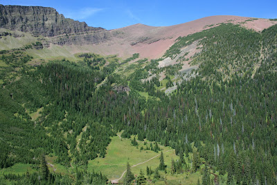
It did work though..

Once down we started just busting through these lakes. There are three of them.

We did not have time to dilly dally…

Enter that whole, we started at noon thing. It is becoming an important part of our trip

So, we hit the first lake which was pretty obvious. We were looking at it all the way down.

After him though, we started moving pretty frantically around this hanging basin trying to find the other two and waste as little time as we could.

There is an efficient and optimal way of doing anything in life. Finding and jumping in remote mountain lakes while working with serious time constraints is no different.

The second lake was over a wooded ridge.

The sun kept falling and creating that soft colorful light on all the rock walls around us. It is lovely, but when you know you have a long way to travel before you are back at the trailhead and in your car. It only creates a bit of anxiety.

Then, off in the completely opposite direction of our exit out of this valley to find the last one. It was right above the cliffs that drain the hanging basin. They drop off into Linham Falls.

There once was a trail up the face of the headwall that holds the lakes in place. It must have had a few cables and chains to hold on to along the sketchy route. At least one person fell to their death through the years, though. Needless to say, no one goes that way any longer.

Not being able to go that way, forced the “random, over the ridge and drop in” route to get to these lakes that we had to take. No matter how difficult it was to get here, at least we did not have to scale a crazy cliff to make our way…

Sorry, that was a tangent….
We found the last lake..

One of the truly ironic things about the project is the amount of work and time that it takes to get to these places… Most often I have to get there….take a dip,…and head directly back out again.

This place would have been a nice place to hang for a bit.

Oh, well…Maybe some day. Right now I just want to make sure that we get out of this hanging basin and back on trail before dark.

It is getting late and we have a big, ridiculous ridge to climb up and six more “on trail” miles to bust out.

So, out we head.

It is situations like this that I am very happy that I use trekking poles. 
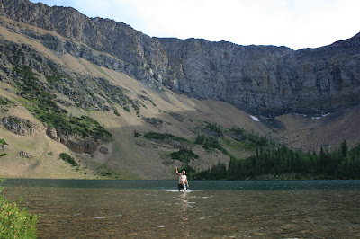
Somewhere through the evolutionary process of most animals,. they found out that “four legs good, two legs bad” is a valuable thing to keep in mind.

Well, atop the ridge we took a few awesome pictures and dropped back into the valley on trail and headed back to the car. 
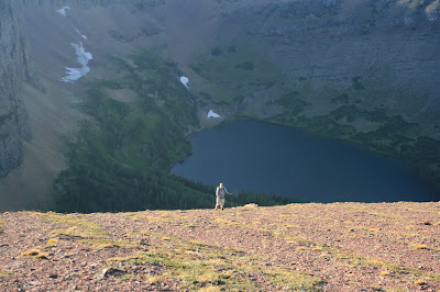
We got out about 30 minutes after dark. Never great, but it is so much better when it’s dark and your on trail. Dark when your off trail is “No Bueno”!!!

So,..thats that. Upper Rowe Lakes and the three Linham Lakes.

Check!

All went well. Keith and I got our annual hike in. I got to 126 lakes and busted out a great day with the help of a good friend and some crazy goats.

Hope your crazy goats are well!!!

To Life,

Marc

Deer Lake – International Lake of Mystery – CAN #118

The International Lake of Mystery….Duh, duh. Duh….

That last part was supposed to be pronounced like it just happened in a mystery movie and some important fact was just uncovered.

Try it again,

The International Lake of Mystery….Duh, duh, Duh…..

How’d it go?

One of the main things about humor that I have found out in my life is that it is not real great if you have to explain it. You certainly dropped the ball, if you are at that point.

Anyhoo….

In comes the saga of “Deer Lake” in Waterton National Park.

So, Saturday was a first for me. I had to access a lake and it was about a quarter mile into Alberta, but it was about two and a half miles from a road and was directly west of the customs station.

So, this meant that the path of least resistance was hiking the boundary swath.

What is that you ask?

If you knew it or not, there is delineation that visually and physically separates the U.S. from Canada. In some places it might just be markers like this one.

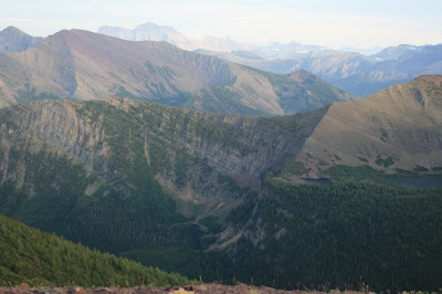
In the plains they may just mow a separation.

When there are forests, there is a 40 foot wide swath or clearing that runs east/west along the 49th parallel. So, since Glacier and Waterton are on the border, there is a boundary swath running east/west and separating the park the whole way.

I swear!!!

Why, I’m not entirely sure…But there is.

So on this particular day the route to the lake was an animal path that runs willy nilly up the boundary swath. I was happy to see that there was even a path, but I suppose the animals think it’s pretty cool that we keep this big clearing for them in the middle of the forest.

My friend’s cousin, Curtis and I drove through Canadian Customs. Had a really nice conversation with the nice men at the port and headed down the hill.

At the bottom of the ridge, we had to ford the Belly River. 
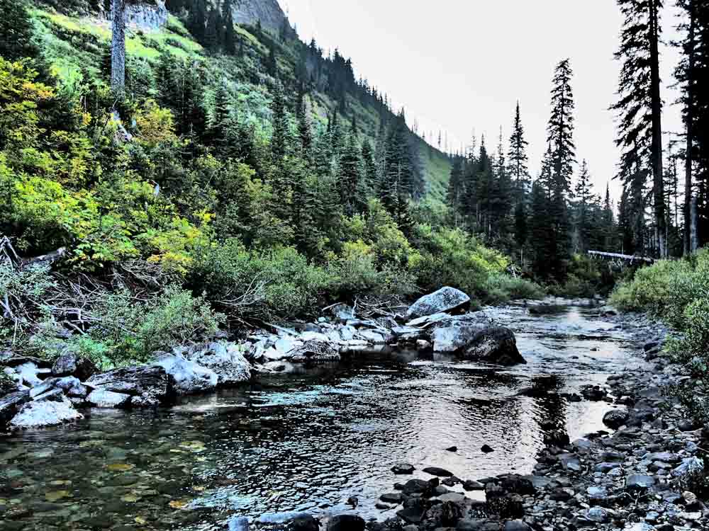
The water is low enough now that it is safe. Earlier in the summer it would have been terrifying.

The deal with this whole hike was that we had to stay in the swath. If we left it, it had to be to the north. We had entered into Canada, so we would be illegally entering into the country if we walked out of the swath to the south and back into the U.S.

All of this sound odd and a bit silly? I agree, but that is international law. I’m lucky that they extended this option to me to begin with.

After the river we found a nice mucky swamp and because of this tiny little rule, instead of walking around the swamp to the south, we had to walk straight on through. There was no end to it if you walked north…

Straight on through it was. The muck on the bottom of the swamp almost sucked my sandals off of my feet. I then lost my balance and basically fell face first into the swamp. I dunked my boots and half my stuff. I came out smelling awful. Note* This was not the swamp, it was the swamp after it that we could walk around. I have no pic of the awful boundary swamp. I am sorry.*

But we were in compliance with the law!!! I want to continue to make that very clear!

So, finally we headed back up the other ridge after the dreaded boundary swamp. It was really a pleasant walk. The animals cleared a great path the whole way until we had to deal with that “1/4 mile into Canada” part.

It is funny to be walking through a perfectly clear and very wide path with thick, impenetrable forest on both sides. Odd feeling, for sure.

So, we schwacked our way over, under and around the forest for a good while until we found a pretty pleasant lake. I was surprised because many of the small, forested lakes are really not too pleasant.

I spoke with a few guys who work for Waterton National Park and they said that they had both flown over it through the years. One said it was almost dried up at the end of a hot, fire filled season. The other said that he saw a moose swimming in it.

Now I have.

Lake #118

On our return we even found an amazing moose skull hidden in the willows.

Shaheeya Lake – A REALLY Late Night

Wahseeja Lake from Shaheeya Peak

First of all this is a misleading photo, it is from this trip, but not of Shaheeya Lake. I just liked it and it ended up downloaded on my blog twice. So I wanted to find a place to put it. So at the top is where is landed.

I wanted to tell you about a lake endeavor called Shaheeya Lake.   My friend Matt came to visit and the poor guy ended up on a quest for the lost Shaheeya Lake. It is not exactly that it was lost; we knew where it was…it was just crazy rough to get to it.

 There is a ridge that is just south of the Canadian border and smushed up in multiple pockets in this ridge are the “Boundary Lakes”. There are five of them and all of five are completely off trail. They have been looming over this project like a little mini lake project to them selves. There has been two separate endeavors and we have only gotten to three so far.

There still stands Wahseeja and Carcajou Lakes, which are going to prove to be the roughest, most, removed pockets in the series of five. Ah, those are for another day… This is Wahseeja Lake, I’m looking down on it during the Shaheeya trip.

It is funny; I have heard that you only run another marathon after you have forgotten how much the first one hurt. When we left for this hike the idea was to hopefully get Wahseeja Lake also, but like I said,…for another day…A day in which I have forgotten the pain of the last marathon.

So we started entirely too late,…mid morning out of Goat Haunt. Shaheeya lives about 3000 feet above Lake Janet and over on the other side of Shaheeya Peak. So there really is no special way to get there, it just just “UP!!!” Unfortunately “up” does not mean an easy scramble up a drainage or up a nice gradual ridge line.

The Waterton Valley is known for it’s dominating ground cover. Tree’s too, but where there are not many trees on this route, but there is alder and sub alpine fir and every other burly northern rocky mountain short angry ground cover known to foot travel. This is exactly what we dealt with for three thousand straight vertical feet. We started climbing up an avalanche chute that runs directly north of Lake Janet. 
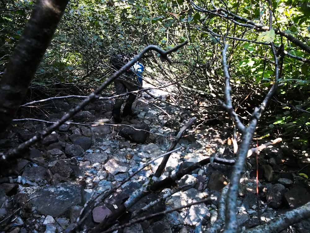
With in minutes, we were already in tree/bushes/crud that was over our head and we had really just begun. It got so rough at points that I literally got on my belly and crawled under some bushes because they were so tightly woven that it was the path of least resistance.

After about 2000ft we popped out into shelves of rock and this at least afforded us some nice spots to stop, eat and admire the northern expanses of Glacier Park. The going kept getting steeper and steeper until we eventually hit one last thick strand of sub alpine firs and popped out right below Shaheeya Peak. Not exactly our intention, but it handed us one of the best mountain top views of my life.

Matt on Shaheeya Peak

Often on these endeavors; I toil all day and still never really leave a thick valley bottom in search of these bodies of water. It is tough to complain when indirectly you get to climb a really remote and amazing peak in search of a swimming hole. That is exactly what happened today.  So we enjoyed the summit for a while and then found our lake, which we had to drop a thousand feet back down on the other side of the ridge to get to. 
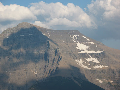
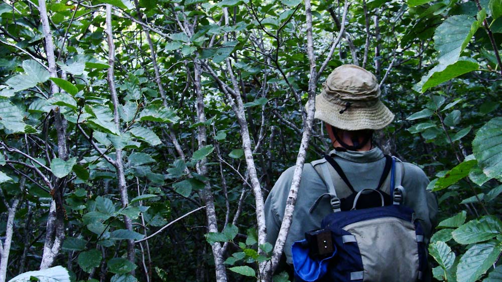
The bugs were rough, we had to keep moving which is tough to do when you are dead tired and have to switch into some swimming trunks. Funny that no matter how hard you try, there really is no where without mosquitos. NOWHERE!!

So we thought that the hard part was over and we made our way to a different drainage to descend. You never know what you are going to get. Although, do I know of a couple people that have gone up and down this way. Seems that maybe it would work better if you came up and then you would in turn know how to go back down. But, down we went none the less.

Much of the day had already been spent by this point and the surrounding mountains were starting to get that amazing late day glow. 
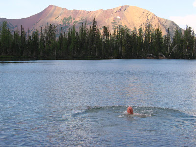
Down we went. It was actually going quite well, we had solid rock chutes to climb on and the going was a bit easier than in the avalanche slope. Down we went……

Till about half way between the ridge top and the main trail in the valley bottom we hit a cliff band. There is a term in the world of mountains called “cliffed out”…no matter what your experience with mountains, I would imagine that you can guess what that means. It happens to everyone, once in a while. Lucky, many times you can climb back up and try another route. Although when it is already 7pm to 8pm at night and you spent ten hours getting to where you are currently, that is less of an option.

This is were Matt flys in with a cape and mask combo pack and saves the day. He commited to climbing down a few cliffs that would be virtually impossible to climb back up. The day grew on and the sun dropped further. Eventually, at the exact last minute he found what he thought “might work”….”might work”….?

There are moments in life where you simply have no choice but the follow what “might work”. What other option do you have? That there my friend is life. When there is no nice bow tied on the top and you don’t have a catered lunch sitting there for you,…sometimes…you go with what “might work”…And we did.

What “might work”,…worked! We now had about a half hour of day light. We thrashed out way down through alder and all the wonderful other vegetation that the hillside supported so well. Eventually hitting the trail at exactly dark.

This is why one does not endeavor into the wilds without a head lamp. Always bring that head lamp. All those times when you are annoyed that you are carrying around these “emergency supplies” and your back hurts and you think that you “got this one”….BRING THE HEADLAMP!

We hiked the last four miles out in the dark. Funny how giving a yell to warn bears of your presence increases frequency by a lot when it is pitch dark out and you are the only two knuckleheads roaming around in the dark night.

This honestly was one of the most intense, physical and emotional outputs in the form of a hike in my entire life. I have to dedicate this one to Matt. When the going got ugly and we just wanted to get back to the burritos that were waiting for us at the end of the trail…

Matt found what “might work” and nailed it. So to you my friend and faithful hiking partner. I appreciate you watching my back and bring us down the mountain. Sleeping under the stars down not sound like as much fun when you are on a 45 degree slope and 1500ft above the valley floor…Esecially when those burritos were getting cold.

To Life,
Marc