
Pocket Lake. Well, well, well…It’s August, 2010 and somehow this is my first blog entry. Instead of recounting my reasons for being so busy, I will recount the lake that jarred loose the keyboard.
Pocket Lake.
Oh, but before I do that, I want to thank the people at National Geographic. In three days (August 30, 2010), there will be a documentary called Glacier National Park – Wild Spaces that will make its debut on the National Geographic Channel.
Any of you who love the park, have interest in the wild corners of the world, or just want to see me with a farmers tan jumping in cold water should tune in.
It is about the park in general, but for me it marks the first national exposure of the Waterton Glacier Lake Jumping Project. I’m obviously out of my mind excited!!!
So, where was I…?
Oh, Pocket Lake.
Jump Stats brought to you by The Jump Tracker 3000

Pocket Lake – Jump #132
-
Lake: Pocket Lake
-
Lake Jump: #132
-
Completion Date: August 20, 2010
-
Distance: 29 miles
-
Difficulty: Strenuous
-
Off Trail Distance: 3 miles
-
Elevation Change: 4500 feet
-
Length of Trip: 2 days
-
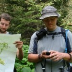
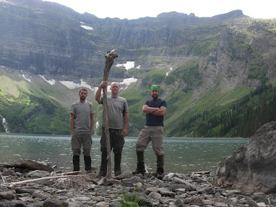
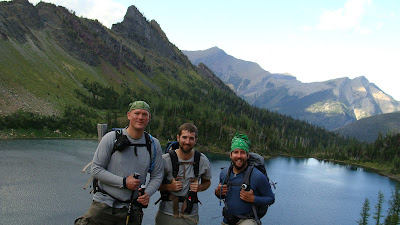
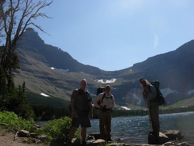
Lake Jumpers in attendance: Jessi Adams
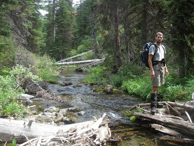
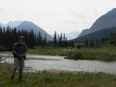
So, for the first time in this busiest of summers, my now wife Jess and I went on a backpacking trip. You get three days off together around here and you jump on it.


On the way to our first night of camping, we cooled off in Thunderbird Pond. This lake is on the list, but I got to it many years ago. Still good for a nice dip.


It has been a little while since we had been up in these parts so both Jess and I were super excited. 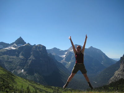
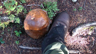
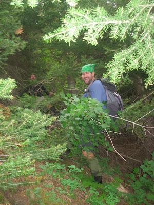
There was a bountiful crop of Montana’s famous huckleberries. Its funny. Although they keep you going, they also seriously slow you down. 
But, there is no better distraction. Bears have it figured out, folks.
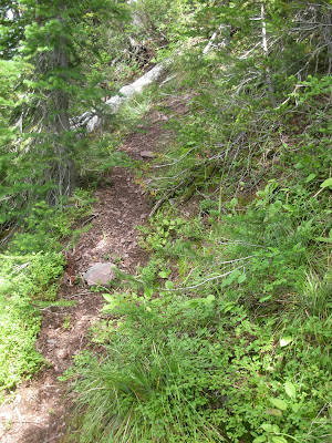
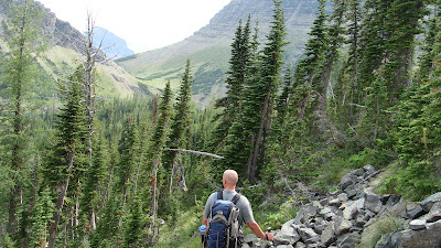
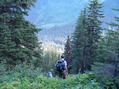
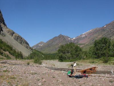
So, the next morning we drug our tent a few miles up hill to a site called Hole in the Wall. From here we continued up hill, the trail meandering through the rock bands to Boulder Pass.

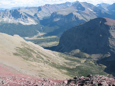
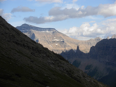
Would you believe that in the earlier parts of the 1900’s this whole picture would have been filled with Boulder Glacier and the trail had to lead up on the moraine in the right hand side of the picture. 
Lots of things have changed around these parts since then.


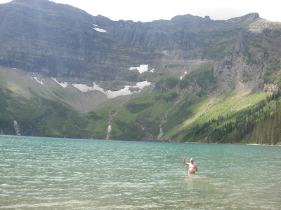
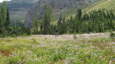
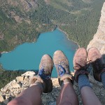
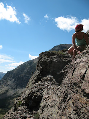
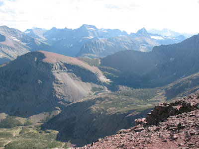
Just over the pass we had to go off trail to the top of a ridge.At the bottom was the long awaited Pocket Lake.
 We had to drop off of this ridge and work our way through some cliff bands, steep grass and flower filled slopes to get to the lake.
I don’t have any pictures of our way through the cliff bands. That is probably because I did not like it.
Sometimes, you end up finding yourself with your heart racing as you hold onto a tree limb and try to scoot yourself down a wet rock band covered in moss. Just sayin’….Sometimes that happens…Jess kept her cool and pulled me through. You’re the best!
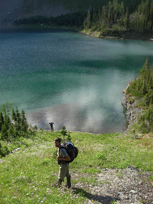
 We made our way along a huge bench above the lake and then down broken cliff bands and grassy slopes down to the lake.

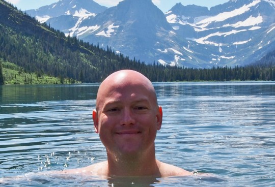
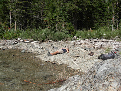
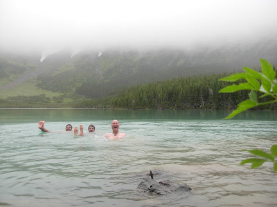
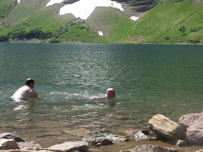
The lake was amazing. Somehow we scored three spectacular days of sunshine and calm weather.  This would have been impossible if the storms moved in on us. This is one of the highest elevation lakes in the whole park.
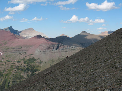
Lets give it up for the weather!!Thanks everyone.We still had to get out of this enormous “pocket” though. So since we were losing daylight we had to head out and climb back up to the pass.

We knew it was “the way in” when we saw that there was a nice animal path up the ramp. Steep and slippery, but well more straight forward.
Once back up top, we bid Pocket Lake farewell and headed on. We still had miles to make.

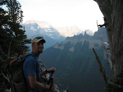
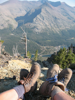
The view from atop Boulder Pass looking back towards Goat Haunt is about as good as it gets in the park. Wow!! 
And with the last hour or so of sunlight for the day, we dropped back down to camp.  The light softening the colors on the peaks we were surrounded by.

To finish the story, we made a late morning of it the next day. Felt like we earned a bit of sleeping in.
Good bye Boulder Pass. Good bye, Bowman Lake. Good bye, Goat Haunt.

I would like to point out to anyone reading this blog for the first time, that I have many past adventures to read about. So, continue sifting through the blog. Check out all of the other parts of the website too. www.firstgiving.com/glacierlakejumps
Anyone that has searched out the Waterton Glacier Lake Jumping Projects website, Welcome!!
I’ve been trying to harness this project to raise awareness for childhood cancer and to raise money for Camp Mak A Dream. I have been working on the project for seven years now.So, thanks for popping by.

If you donate,….well your awesome.
If you check out the site and enjoy yourself enough to tell others then, you are Awesome too.
I have 34 lakes left after the six I’ve done this summer so far. I’ll keep plugging if you keep reading and following along.
Till then, I bid you farewell.


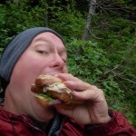
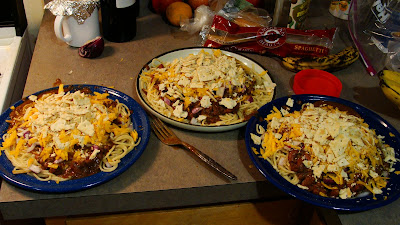 For anyone who knows about this delicacy, you understand how happy I was to have a communal chili feed in the middle of nowhere.
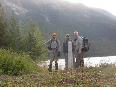 We said hello to the obelisk that marks the border and we headed west three and a half miles till we saw an entrance to a heavily wooded side valley that no one I have ever met has gone up.
 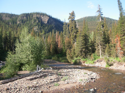 I’m sure its happened, but boy oh boy… would it be few and far between.
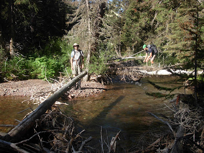 Then into the guts we go.
 That always ends and gives way to a thick tree filled mess.
 Shortly after crossing it, we finally came to the first of our objectives.
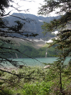

 We were essentially going from one main valley to the next, but over, under and through the middle of nowhere.
 No jumping pics.
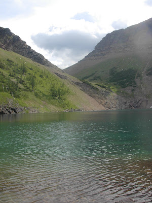
 Man that thing is nice.
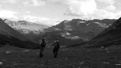


 By nightfall it was as if there were no mountains.
  Only rolling forested hills could still be seen though the white misty haze.


 It has been a bizarrely wet season. We have had over three times the normal amount of precipitation.

 In the plains they may just mow a separation.
 So, since Glacier and Waterton are on the border, there is a boundary swath running east/west and separating the park the whole way.
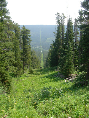

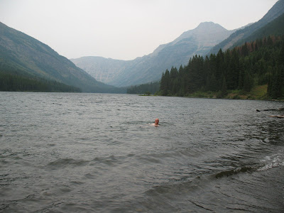
 The water is low enough now that it is safe. Earlier in the summer it would have been terrifying.
 Note* This was not the swamp, it was the swamp after it that we could walk around. I have no pic of the awful boundary swamp. I am sorry.*
 Odd feeling, for sure.
 I was surprised because many of the small, forested lakes are really not too pleasant.


 They even submerged themselves with an underwater camera and had me swim over them and swim at them. Crazy. I still can’t believe that this happened. Know?
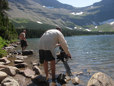 Getting out, getting back in. Getting back out again.
 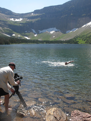 Swimming back
 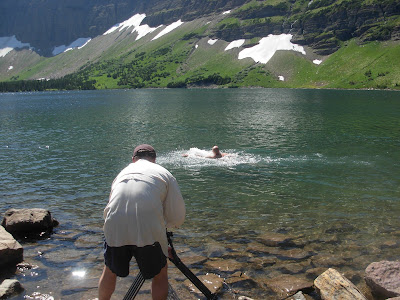 and forth and
 back again.
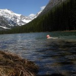

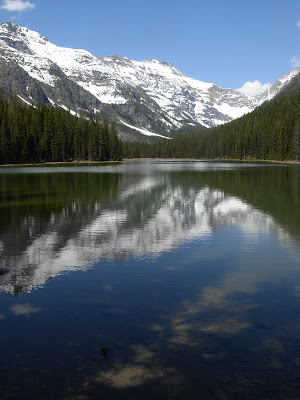
 It is the Winona and Green Lakes of the project that are my arch nemesis.
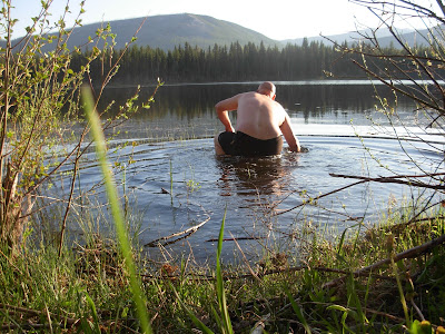
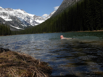
 The trail leads out of the Bowman Lake valley.
 It was a perfect day, warm, clear and free of snow. The weather this May and June so far has been amazing. It was certainly one of those choice days.
 It is on a remote road in the northwest corner of the park.
  Its name used to be Mud Lake and I suppose the “powers that be” thought that was a bit unflattering.
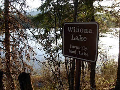 So, a while back it became Winona Lake.
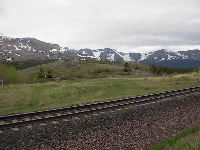
 I laid down in it.

 This is Wahseeja Lake, I’m looking down on it during the Shaheeya trip.
 This is exactly what we dealt with for three thousand straight vertical feet. We started climbing up an avalanche chute that runs directly north of Lake Janet.
  With in minutes, we were already in tree/bushes/crud that was over our head and we had really just begun.
  It got so rough at points that I literally got on my belly and crawled under some bushes because they were so tightly woven that it was the path of least resistance.
 The going kept getting steeper and steeper until we eventually hit one last thick strand of sub alpine firs and popped out right below Shaheeya Peak. Not exactly our intention, but it handed us one of the best mountain top views of my life.
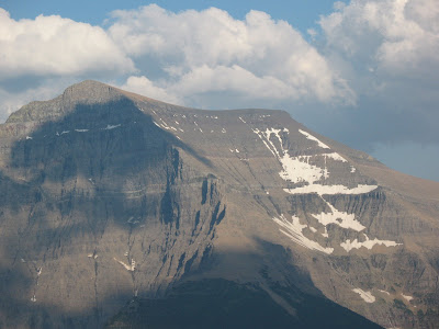

 The bugs were rough, we had to keep moving which is tough to do when you are dead tired and have to switch into some swimming trunks. Funny that no matter how hard you try, there really is no where without mosquitos. NOWHERE!!
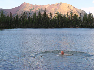

 Down we went. It was actually going quite well, we had solid rock chutes to climb on and the going was a bit easier than in the avalanche slope. Down we went……
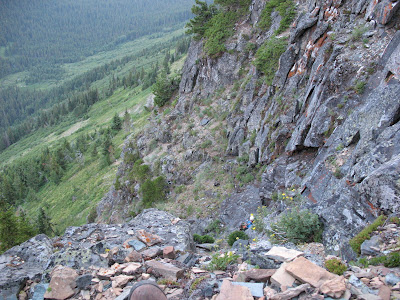


 Some of you may know this as one of the sites of the famous “Night of the Grizzly”maulings. For those that don’t know, here is a quick over view.
 You can see Lake Nooney and Lake Wurdeman from a real common trail in Canada. They are amazing lakes. Huh? This picture was taken many years ago and have been excited to down there ever since.

 The trip was a good time though. My friend Clay and I headed back there one afternoon. He laughed the whole time cause all I did was lay down in them.
  I’ll spare you the pictures.They had to get done, but boy it’s moments like that were I can’t believe I opened my big mouth and said this was my goal. Cold water does not bother me, but mucky, muddy, goo does.
 I decided to add the 30 named lakes in Waterton National Park in Alberta to the lakes project. We are Waterton/Glacier International Peace Park. Why not include them.


 I would like to dedicate this entry to a guy named Mark. I don’t know his last name, but he was cool and from Oklahoma. He worked out here for a few summers and we hung out and played some great music. He was a good guitarist, and a great guy. He died about a week ago, driving to work in Oregon. Either he fell asleep or his car gave out or something, but he went off the road and died. This park will miss him and he will miss this park. He attacked it in large bites, which is always admirable.
 The red scree slope in the center is directly above Sky Lake in a small hanging valley. During the early season there is a spectacular waterfall that jets right out of the hanging valley and runs a couple thousand feet to the main valley below.
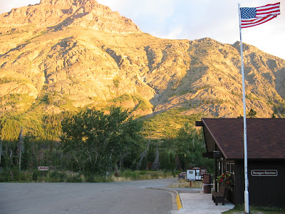 Easy as that…huh?

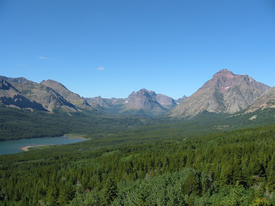
 The campground is to the left next to Pray Lake and then the ranger station, picnic area, camp store and boat docks are to the right on Middle Two Medicine Lake.


 Thanks for the glasses Anna.


 Why at those exact moments, does the theme to Three’s Company get stuck in your head? Anyone????
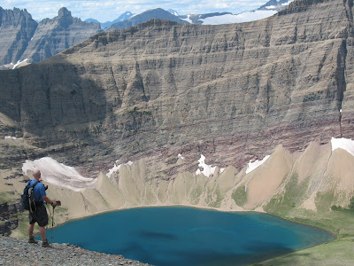 We dropped in on it which took a while.
 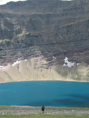 I love it, plenty of people have seen this lake from surrounding mountain peaks, but virtually nobody ever goes down to it. It’s an amazing lake, so much color. Great spot for a short lunch….. and a dip
 Beleive it or not, there is a person in the middle of that slope in the picture above…Where in the world is Waldo,huh?
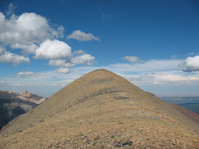 Amazing views from up there.
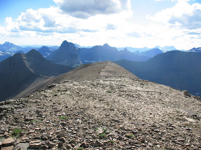

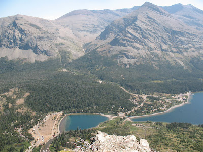
 All the way down there at the end of the valley is where our car is parked.