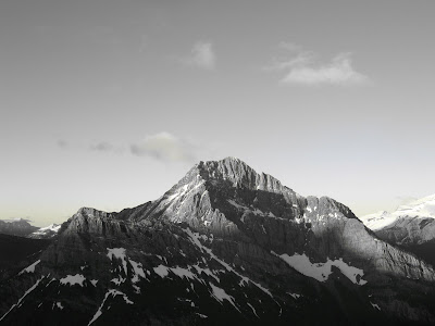

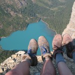
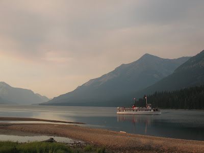
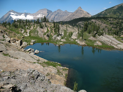
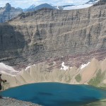
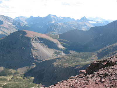
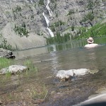
Wahseeja Lake from Shaheeya Peak
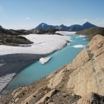
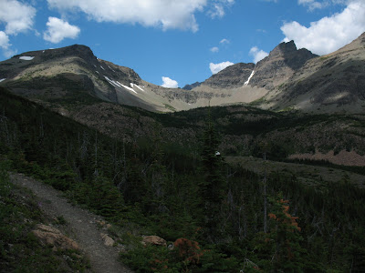
First of all this is a misleading photo, it is from this trip, but not of Shaheeya Lake. I just liked it and it ended up downloaded on my blog twice. So I wanted to find a place to put it. So at the top is where is landed.
I wanted to tell you about a lake endeavor called Shaheeya Lake. My friend Matt came to visit and the poor guy ended up on a quest for the lost Shaheeya Lake. It is not exactly that it was lost; we knew where it was…it was just crazy rough to get to it.
There is a ridge that is just south of the Canadian border and smushed up in multiple pockets in this ridge are the “Boundary Lakes”. There are five of them and all of five are completely off trail. They have been looming over this project like a little mini lake project to them selves. There has been two separate endeavors and we have only gotten to three so far.
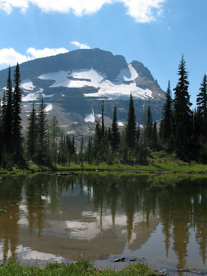
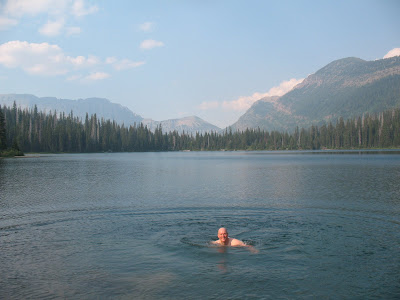
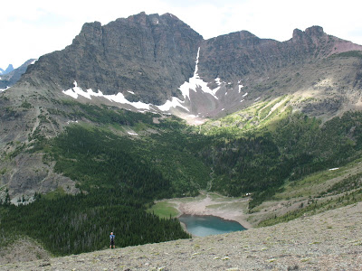
There still stands Wahseeja and Carcajou Lakes, which are going to prove to be the roughest, most, removed pockets in the series of five. Ah, those are for another day…  This is Wahseeja Lake, I’m looking down on it during the Shaheeya trip.
It is funny; I have heard that you only run another marathon after you have forgotten how much the first one hurt. When we left for this hike the idea was to hopefully get Wahseeja Lake also, but like I said,…for another day…A day in which I have forgotten the pain of the last marathon.
So we started entirely too late,…mid morning out of Goat Haunt. Shaheeya lives about 3000 feet above Lake Janet and over on the other side of Shaheeya Peak. So there really is no special way to get there, it just just “UP!!!” Unfortunately “up” does not mean an easy scramble up a drainage or up a nice gradual ridge line.
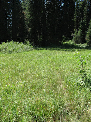
The Waterton Valley is known for it’s dominating ground cover. Tree’s too, but where there are not many trees on this route, but there is alder and sub alpine fir and every other burly northern rocky mountain short angry ground cover known to foot travel.  This is exactly what we dealt with for three thousand straight vertical feet. We started climbing up an avalanche chute that runs directly north of Lake Janet.
  With in minutes, we were already in tree/bushes/crud that was over our head and we had really just begun.
  It got so rough at points that I literally got on my belly and crawled under some bushes because they were so tightly woven that it was the path of least resistance.
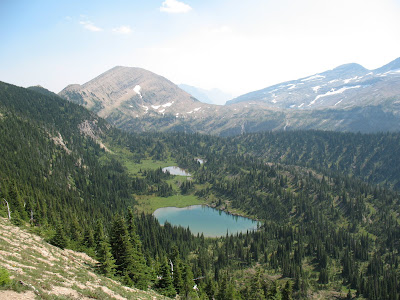
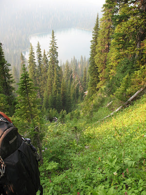
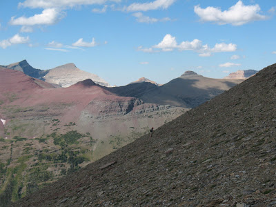
After about 2000ft we popped out into shelves of rock and this at least afforded us some nice spots to stop, eat and admire the northern expanses of Glacier Park.  The going kept getting steeper and steeper until we eventually hit one last thick strand of sub alpine firs and popped out right below Shaheeya Peak. Not exactly our intention, but it handed us one of the best mountain top views of my life.
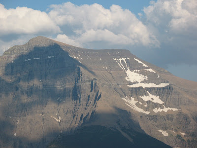

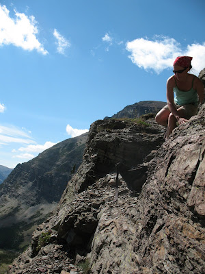
Matt on Shaheeya Peak
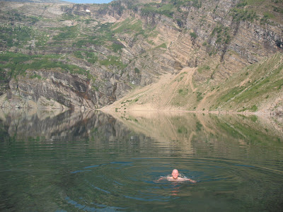
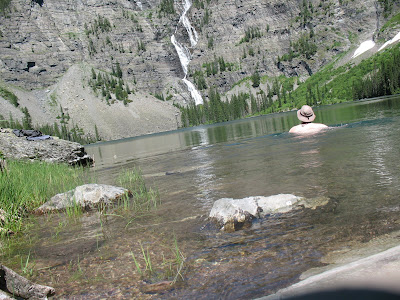
Often on these endeavors; I toil all day and still never really leave a thick valley bottom in search of these bodies of water. It is tough to complain when indirectly you get to climb a really remote and amazing peak in search of a swimming hole. That is exactly what happened today. So we enjoyed the summit for a while and then found our lake, which we had to drop a thousand feet back down on the other side of the ridge to get to.  The bugs were rough, we had to keep moving which is tough to do when you are dead tired and have to switch into some swimming trunks. Funny that no matter how hard you try, there really is no where without mosquitos. NOWHERE!!
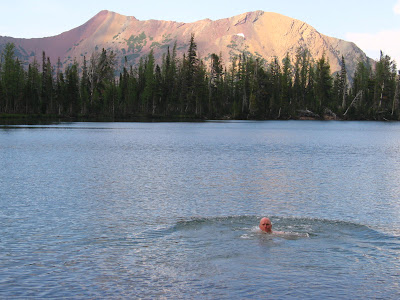
So we thought that the hard part was over and we made our way to a different drainage to descend. You never know what you are going to get. Although, do I know of a couple people that have gone up and down this way. Seems that maybe it would work better if you came up and then you would in turn know how to go back down. But, down we went none the less. 
Much of the day had already been spent by this point and the surrounding mountains were starting to get that amazing late day glow. 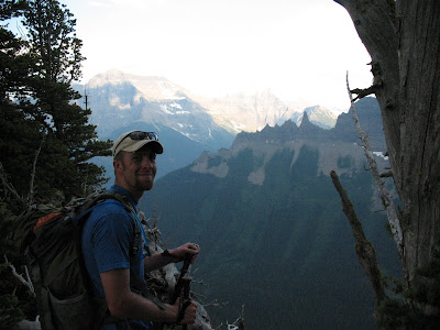 Down we went. It was actually going quite well, we had solid rock chutes to climb on and the going was a bit easier than in the avalanche slope. Down we went……
Till about half way between the ridge top and the main trail in the valley bottom we hit a cliff band. There is a term in the world of mountains called “cliffed out”…no matter what your experience with mountains, I would imagine that you can guess what that means. It happens to everyone, once in a while. Lucky, many times you can climb back up and try another route. Although when it is already 7pm to 8pm at night and you spent ten hours getting to where you are currently, that is less of an option. 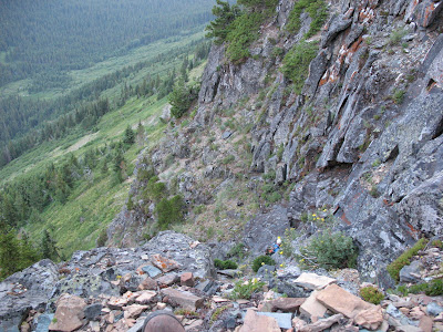
This is were Matt flys in with a cape and mask combo pack and saves the day. He commited to climbing down a few cliffs that would be virtually impossible to climb back up. The day grew on and the sun dropped further. Eventually, at the exact last minute he found what he thought “might work”….”might work”….?
There are moments in life where you simply have no choice but the follow what “might work”. What other option do you have? That there my friend is life. When there is no nice bow tied on the top and you don’t have a catered lunch sitting there for you,…sometimes…you go with what “might work”…And we did.
What “might work”,…worked! We now had about a half hour of day light. We thrashed out way down through alder and all the wonderful other vegetation that the hillside supported so well. Eventually hitting the trail at exactly dark. 
This is why one does not endeavor into the wilds without a head lamp. Always bring that head lamp. All those times when you are annoyed that you are carrying around these “emergency supplies” and your back hurts and you think that you “got this one”….BRING THE HEADLAMP!
We hiked the last four miles out in the dark. Funny how giving a yell to warn bears of your presence increases frequency by a lot when it is pitch dark out and you are the only two knuckleheads roaming around in the dark night.
This honestly was one of the most intense, physical and emotional outputs in the form of a hike in my entire life. I have to dedicate this one to Matt. When the going got ugly and we just wanted to get back to the burritos that were waiting for us at the end of the trail…
Matt found what “might work” and nailed it. So to you my friend and faithful hiking partner. I appreciate you watching my back and bring us down the mountain. Sleeping under the stars down not sound like as much fun when you are on a 45 degree slope and 1500ft above the valley floor…Esecially when those burritos were getting cold.
To Life,
Marc

 Some of you may know this as one of the sites of the famous “Night of the Grizzly”maulings. For those that don’t know, here is a quick over view.
 You can see Lake Nooney and Lake Wurdeman from a real common trail in Canada. They are amazing lakes. Huh? This picture was taken many years ago and have been excited to down there ever since.

 The trip was a good time though. My friend Clay and I headed back there one afternoon. He laughed the whole time cause all I did was lay down in them.
  I’ll spare you the pictures.They had to get done, but boy it’s moments like that were I can’t believe I opened my big mouth and said this was my goal. Cold water does not bother me, but mucky, muddy, goo does.
 I decided to add the 30 named lakes in Waterton National Park in Alberta to the lakes project. We are Waterton/Glacier International Peace Park. Why not include them.


 I would like to dedicate this entry to a guy named Mark. I don’t know his last name, but he was cool and from Oklahoma. He worked out here for a few summers and we hung out and played some great music. He was a good guitarist, and a great guy. He died about a week ago, driving to work in Oregon. Either he fell asleep or his car gave out or something, but he went off the road and died. This park will miss him and he will miss this park. He attacked it in large bites, which is always admirable.
 The red scree slope in the center is directly above Sky Lake in a small hanging valley. During the early season there is a spectacular waterfall that jets right out of the hanging valley and runs a couple thousand feet to the main valley below.
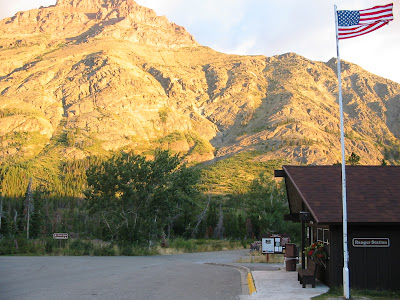 Easy as that…huh?

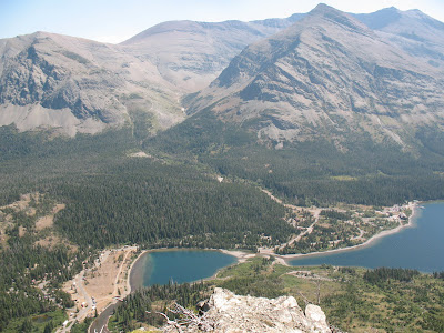 The campground is to the left next to Pray Lake and then the ranger station, picnic area, camp store and boat docks are to the right on Middle Two Medicine Lake.


 Thanks for the glasses Anna.


 My partner in crime, Brad and I hiked five miles south before sunset.


 A wild place where, Brad saw a wolf for a split second, before it dipped back into vegetation.
 When I neared the end, I noticed I had lost one of my prize trekking poles. I looked for 20 minutes, but it was gone, gobbled up by the alder bushes.
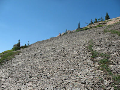 and angular streches of slick vegetation, but it was also early in the day and we over came this section in about an hour.
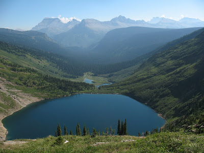 Our camp was at the far end of this lake towards the mountains.
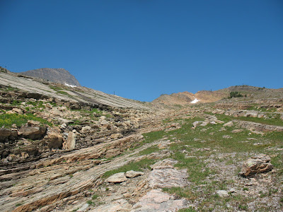

 Gyrfalcon Lake has been on the agenda for years, to finally arrive was pretty great for me.
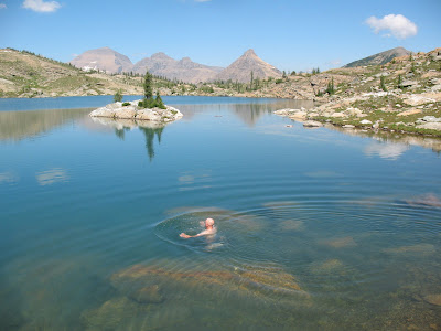


 Why at those exact moments, does the theme to Three’s Company get stuck in your head? Anyone????
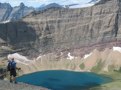 We dropped in on it which took a while.
 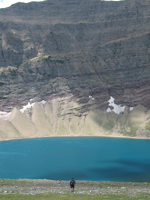 I love it, plenty of people have seen this lake from surrounding mountain peaks, but virtually nobody ever goes down to it. It’s an amazing lake, so much color. Great spot for a short lunch….. and a dip
 Beleive it or not, there is a person in the middle of that slope in the picture above…Where in the world is Waldo,huh?
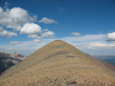 Amazing views from up there.
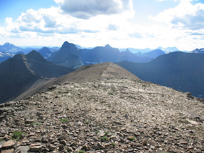

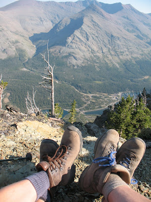
 All the way down there at the end of the valley is where our car is parked.
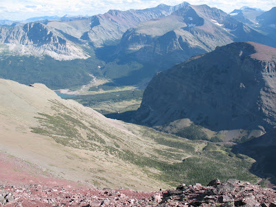


 Back to our view at the top..


 It’s been a long time coming for these two since it’s only about 1 ½ miles from the parking lot of Many Glacier Hotel, but not one step is on a maintained trail. Although through the years it has been done so many times, that there is a path. That path leads through the forest and pops out into a scree slope or a field of tiny rocks that is called the “Red Scree Strolls” in the climbing guide. We saw a first year baby grizzly bear dropping off the side of the slope. Where was momma? Dunno…We became a lot louder and kind of gave it a little time before we continued. Eventually you find this path and it follows along the top of a cliff that runs all the way around Mt. Allen.


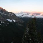


 It’s so great to get such a wild view of how small Goat Haunt is.