Marc Ankenbauer's 10+ year quest to jump in every named lake in Glacier and Waterton National Parks for charity.
168 lakes. Only 17 16 15 14 13 12 11 10 9 8 7 6 5 4 3 2 1
ZERO LAKES LEFT!!!
-- Marc jumped into Fisher Cap Lake on Sunday September 8th, 2013 to complete his goal! --
Read about Marc and how this project started...

Bench Lake-The Land of Alder: Ten Lakes Left!!!

NOTE: The Missoulian article that was written on March 11th, 2013 about the lake project stated that I have 10 lakes left, but up till now the website count still said 11 left.  Pat and I got Bench Lake done right before I left for Antarctica and I was never able to get the story posted before I was whisked away to the Great White South.  So, many months later…Here goes Bench Lake…

Bench Lake has been one of the “hardest lakes”  on my list since the inception of the project.

Since I never know exactly what these places will be like, I can only guess at any point on which is “the hardest lake left”.

The “crux” has ebbed and flowed as I checked off lakes, although Bench has stood atop this list for some time.

While this lake was physically very difficult, the logistics made it even harder.

Before our feet even hit trail we had to travel hours and cross two border crossings, one by car and one by boat.

The trip begins by driving to Waterton National Park in Canada.

From there we took a tour boat down Waterton Lake to a place called Goat Haunt which is back in the United States.

OLYMPUS DIGITAL CAMERA


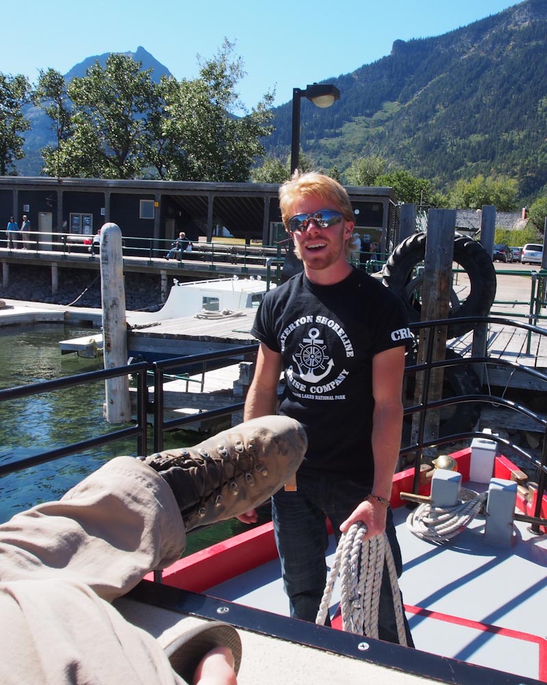
My good friend Keith works on the MV International.

It is the Waterton Shoreline Cruise Company’s pride and joy tour boat.

This historical wooden vessel is 85 years old.

There is no classier way to enter the United States.


Halfway down lake, the boat crosses the U.S./Canada border which is designated by the border swath.

OLYMPUS DIGITAL CAMERA


This is a 100 foot wide clearing that runs the length of the border from Atlantic to Pacific.

Trail crew clears it every few years to keep Mother Nature at bay.


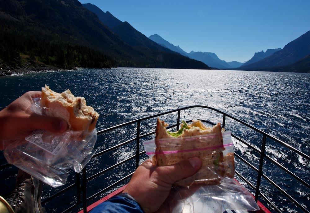
Pat and I have entertained making a website entitled “where I ate my lunch”.

This photo was taken as we enjoyed the most lovely border crossing in the world.

We even had chips…  Two kinds…


OLYMPUS DIGITAL CAMERA

At the southern end of the lake, U.S. Park Rangers and Customs Officials were there to welcome us back into the United States.

They are only welcoming between 11AM and 5PM though,  and don’t forget your passport if you want to enter!

The tiny Ranger Station is referred to as Goat Haunt.

The custom goat weather vane makes it very clear where you have landed.


OLYMPUS DIGITAL CAMERA

I had forgotten my trekking poles and the kind Park Ranger allowed me to use a mismatched pair they had in the corner.

Thanks Nice Park Ranger!!

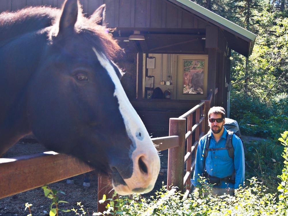
Before we left Goat Haunt, Pat and I stopped by and saw the horse corral.

Pat is neither this small nor is this horse this big.  I swear.


OLYMPUS DIGITAL CAMERA

Goat Haunt is the northern terminus of the Continental Divide Trail which leads from Mexico to Canada.

The trail head sign leading south shows the official CDT emblem.


OLYMPUS DIGITAL CAMERA

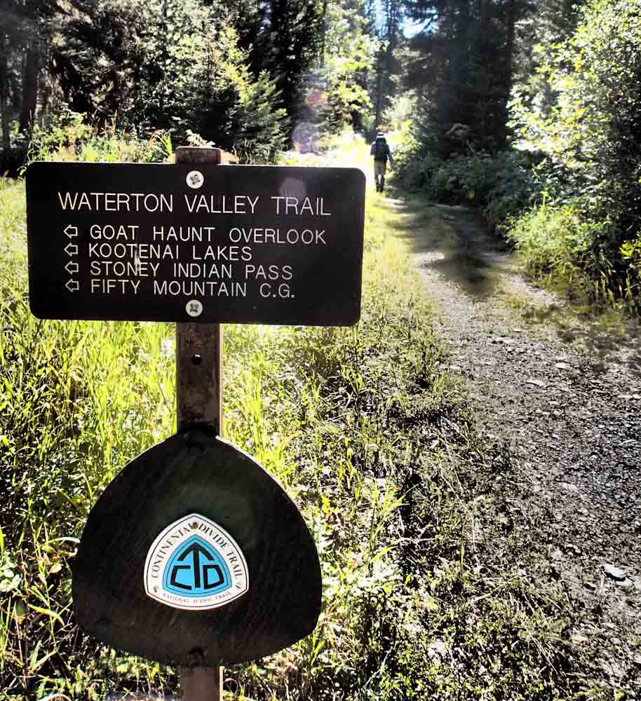
We happened upon a few very excited CDT hikers who were only miles from completing the journey of a lifetime.

Congratulations on your accomplishment folks!

I’ll raise my glass while you put your feet up.


OLYMPUS DIGITAL CAMERA

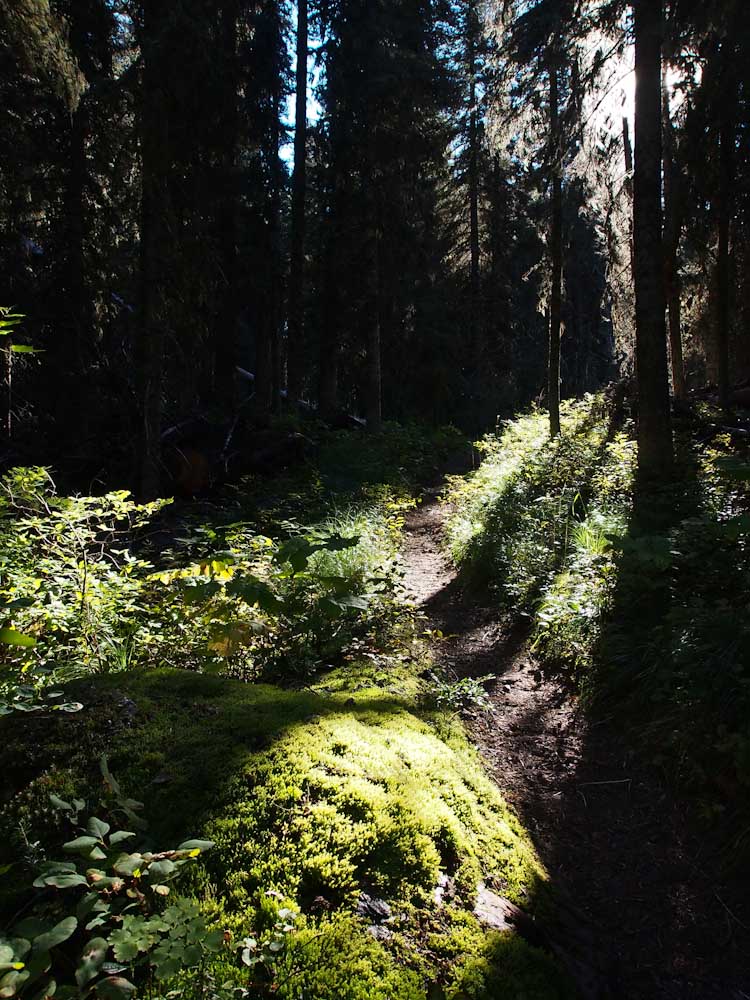
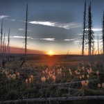
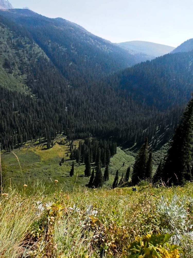
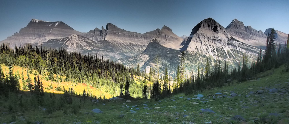
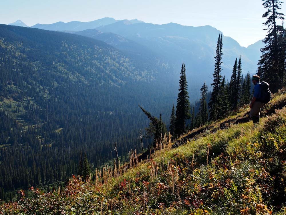
The trail meanders up valley through some of the thickest forest in the park.

Glacier National Park is the wettest part of the entire continental divide and the thick undergrowth and forest in the area show it.

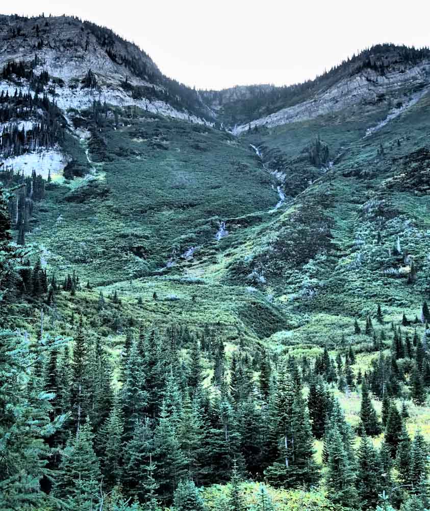
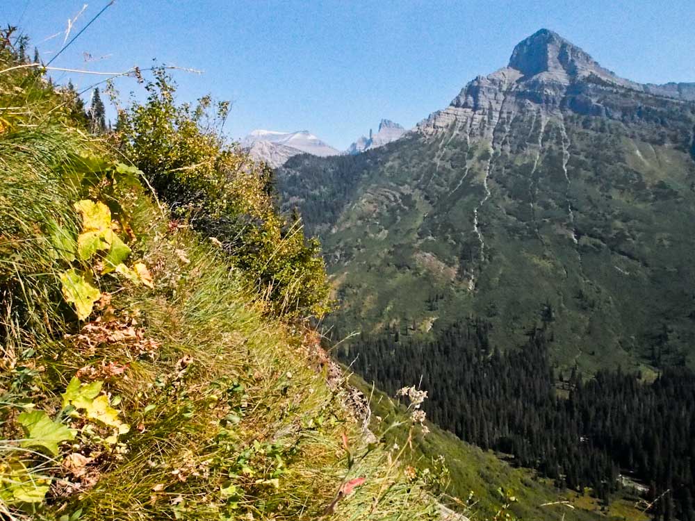
Tomorrow’s objective is tucked into the side of Kootenai Peak.


The waterfalls draining Bench Lake become the Waterton River 3000’ below.


OLYMPUS DIGITAL CAMERA

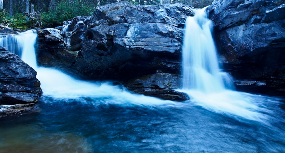
It pools a bit to form Kootenai Lake and then rolls onward into Canada and beyond.


OLYMPUS DIGITAL CAMERA

Night fell as we pondered the tomorrow’s logistics.  Fingers Crossed!


OLYMPUS DIGITAL CAMERA

A cold but clear morning met us as we hit the trail early.

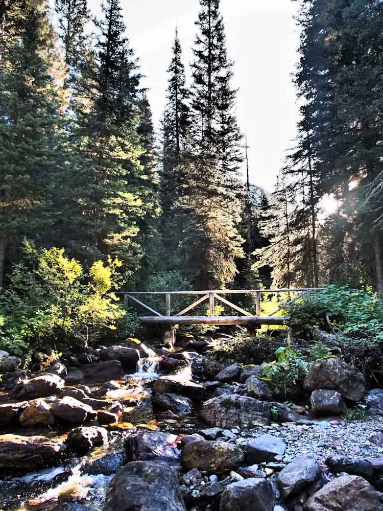
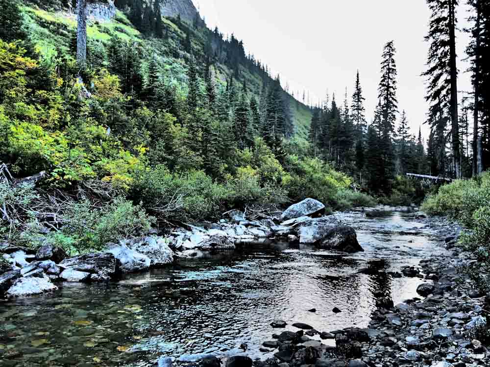
The bridge crossing Pass Creek made a nice spot to have a snack.


OLYMPUS DIGITAL CAMERA

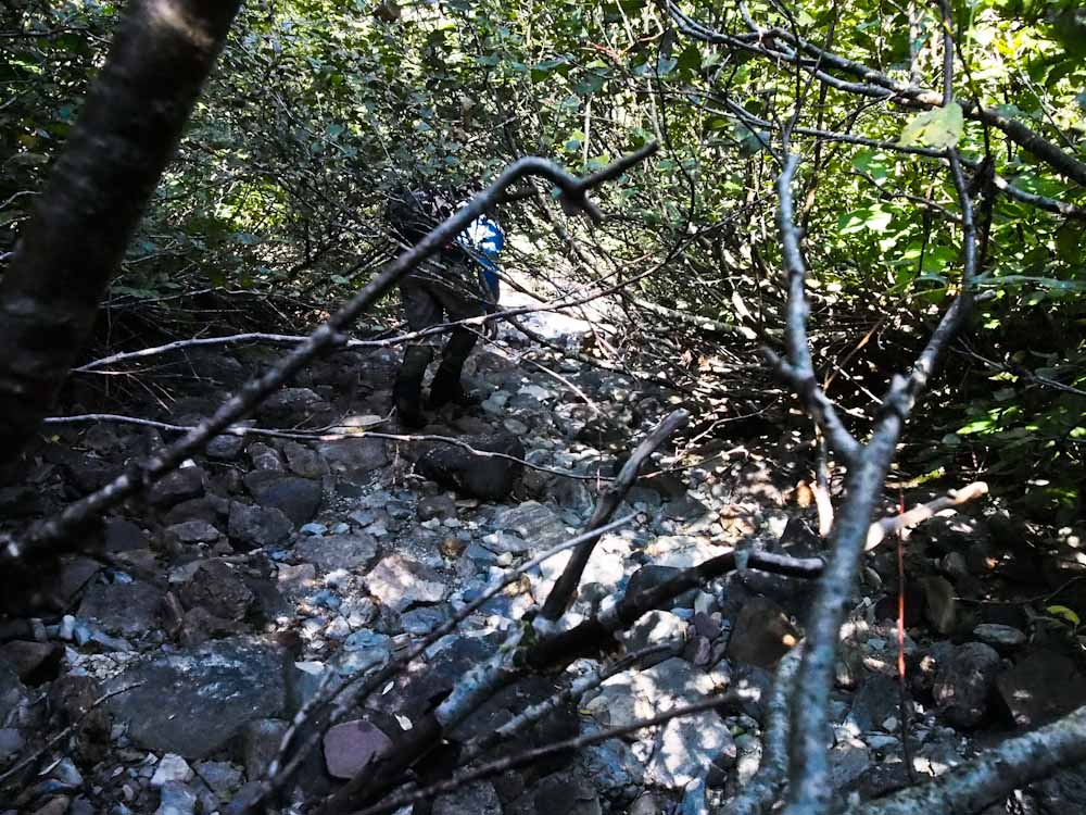
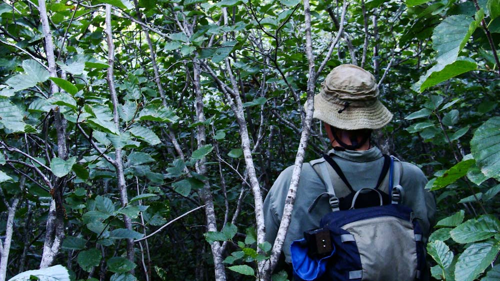
Eventually we struck off into the head high brush instead of continuing on-trail towards Fifty Mountain backcountry campground.

From here, we are talking thick, thick vegetation!

I’ve had conversations with researchers who agree that Goat Haunt vegetation is the thickest they have ever experienced.

Pat and I found an opening to survey our route options.

The direct frontal attack toward the lake looked horrendous.


OLYMPUS DIGITAL CAMERA

We knew any route would be bad, but this looked worse than necessary so we continued up river.

We headed down a dry creek bed that would have been fine for a garden gnome.

Anything that would get us a moment of reprieve from plant material.


OLYMPUS DIGITAL CAMERA


The dry creek bed led us to the Waterton River and a very manageable late season crossing.

OLYMPUS DIGITAL CAMERA


The river and all the waterfall chutes we need to work through would be terrible with higher water.

After crossing we dried our feet, put our boots back on and ate a little snack.

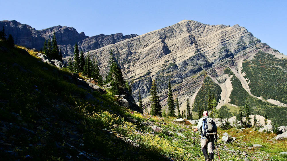
We stood in a meadow staring at what would prove to be the worst part of the whole trip.


OLYMPUS DIGITAL CAMERA

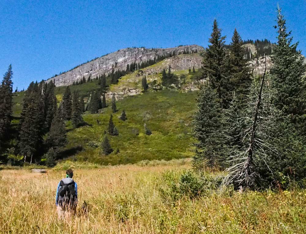
We had a couple thousand feet of what I guess to have been 50 degree angle alder slope.

We literally had to pull ourselves up branch by branch as we were swallowed on all sides by plants.


Bench 16


The limbs were interwoven so tightly we literally had to undo the weave to push through.

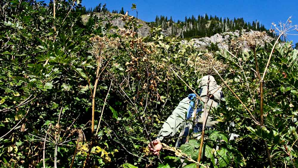
We had to watch what we were grabbing because the ground cover was made of devils club and strawberries.

Strawberries sound innocent enough but they are covered in awful little needles.

Devils Club is aptly named; it’s the worst stuff around.

So if ripping and thrashing up this insane slope of crap wasn’t bad enough we had thorns everywhere.

Bench 17


To make things worse, when we finally punched out of the alder we ended up in a steep, wet cliff band.

This is where Pat steps up in like Superman.

Although he has taken to wallowing around in plant material, bushwhacking has always been more my bag.

He’s a confident mountain goat and has “talked” me through some pretty hairy moments.


I picked lakes for a reason folks.  I’m not great with climbing.

Thanks man.  I owe you big time.

How about a tall Rouge Voodoo Donuts Bacon Maple beer and a cigar?   Deal!


OLYMPUS DIGITAL CAMERA


The slope above the cliffs was insanely steep and we had to bear crawl our way up.

Anyone out there that played football, remember bear crawls?

Now try them with a freaky cliff below you on a slope of hard pack dirt and scrubby plant material.

I was grabbing tiny plants and hoping they held as I tried to just keep my feet moving.


OLYMPUS DIGITAL CAMERA


Eventually we popped out on the ridge and things calmed down a bit.

Hoping for a view of the lake we plodded through off angle bear grass and intermittent cliffs.


OLYMPUS DIGITAL CAMERA


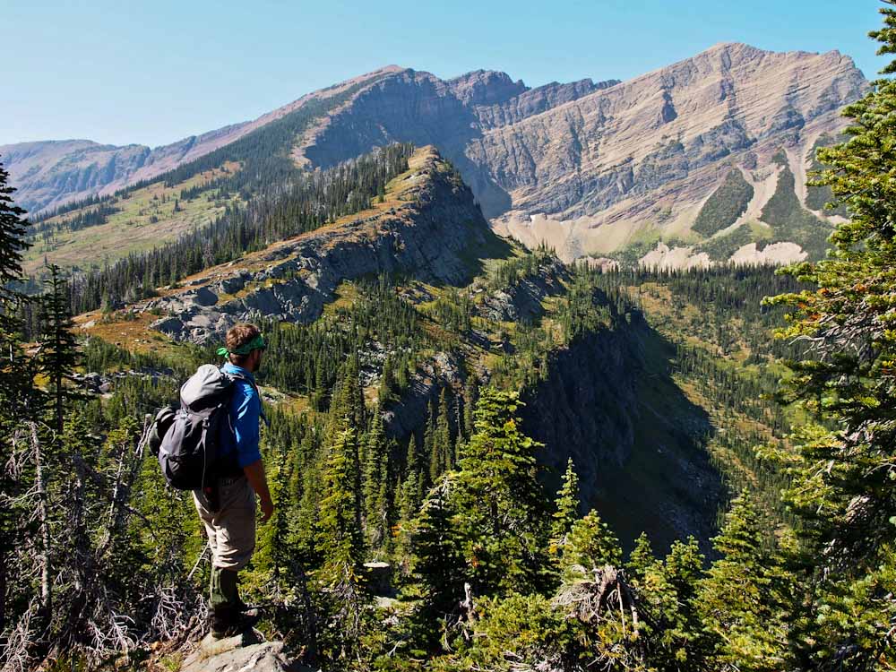
From the top of the ridge we realized that we still had plenty left.

The lake is tucked at the bottom of the main headwall of Kootenai Peak.

Envision that the lake is in the bottom of the pocket of a molar tooth.


Bench 21


We knew light was going to start becoming an issue so we double timed it to the lake.

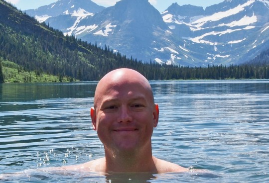
Eventually we were greeted by profoundly beautiful turquoise water.


OLYMPUS DIGITAL CAMERA

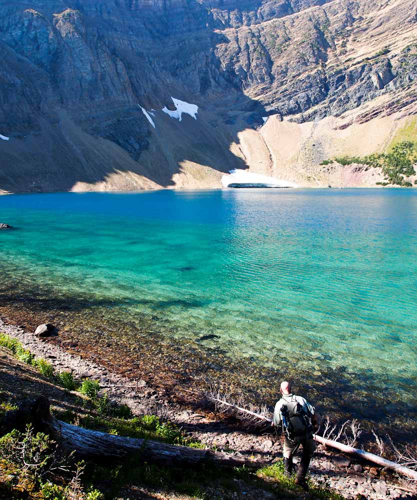
In a rush we both mowed our lunches.

Pat pumped a bunch of water as I got ready to hop in.  .

The lake felt great and helped get the seeds and debris out of my ears.


Seriously though, this was monumental for me.

At the time we were focused on the situation at hand.

But,  I’d been waiting for this moment for a long while.

Bench 23


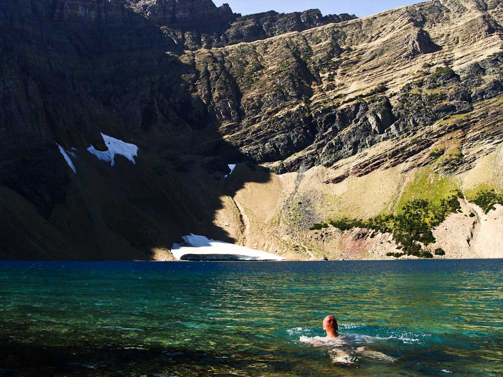
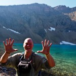
This was BENCH LAKE!!!  My long time arch nemesis!

This thing had been staring me in the face for years.

As I knocked off other members of the “Top 20 List”, or wallowed into other lakes in the Goat Haunt jungle, I was always waiting for this moment.

Plus, I now had 10 lakes left.


OLYMPUS DIGITAL CAMERA


What a great number.

Ten.

How simple and straight forward.

I had ten left.

Not, 67 or 93, or 126 and certainly not 168.

But, 10.

High Five, Bench Lake!


But, now we had to get back before nightfall hits the alder thicket.

We will celebrate later.

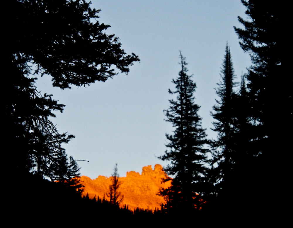
The lighting got more and more amazing as it got later than it should be.

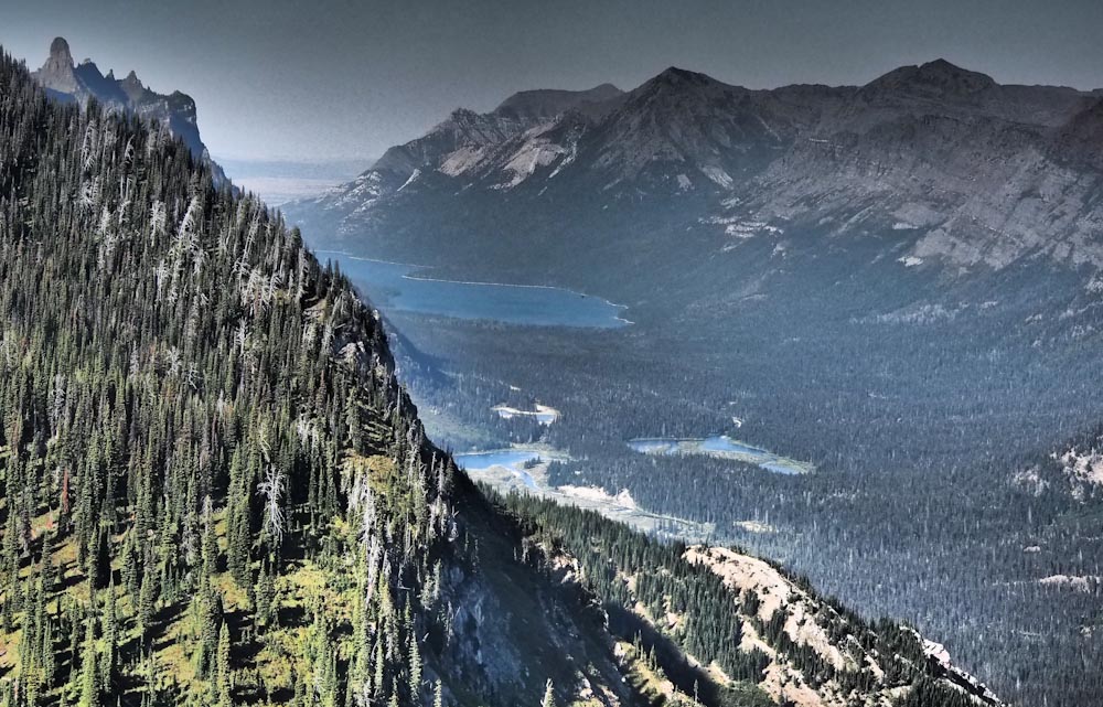
We stared off from an odd vantage point in which most never see.

We looked directly across at the parks high point, Mt. Cleveland.  All 10,461 feet of it.

Next to it stood Stoney Indian, Cathedral and Wacheechee Peak all surrounding Stoney Indian Pass

OLYMPUS DIGITAL CAMERA


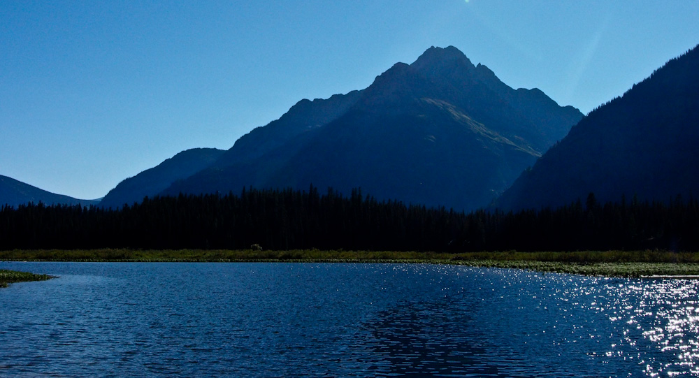
We gazed North into Canada past the Porcupine Spires, Kootenai Lakes and Waterton Lake.


OLYMPUS DIGITAL CAMERA


I saw the tour boat leaving Goat Haunt which meant it was 5:30.

And it was not getting any earlier.

As we cruised south along the ridge we stared off at the mountains that shadow the northern Highline trail.


OLYMPUS DIGITAL CAMERA


To the West was the remote upper Waterton Valley with Nahsukin Lake, Vulture Peak and the rest of the Livingston Range.


OLYMPUS DIGITAL CAMERA


Keep Moving!

Down a steep rocky chute to gain the correct exit ramp.

Keep Moving!

Try to stay upright sliding down slopes of uneven bear grass.


OLYMPUS DIGITAL CAMERA


We walked the ridge further south so we could bypass those blasted cliffs.

Keep Moving!

Back into the thickest alder on earth.


Bench 30


We weren’t even touching the ground at a lot of times.

Keep Moving!

Two daffy goof balls yelling “Hey Bear” and laughing in that not totally there kinda way.


In the end our pants looked like we did battle.

A Vegi battle.

A Waterton River Vegi Battle.


OLYMPUS DIGITAL CAMERA


Once we hit Waterton River we knew we were going to be alright.

We moved happily back towards camp which was still miles away.

We weren’t in alders anymore and that’s all that mattered.

I would like to thank Waterton Valley for safe passage.

She allowed this to happen and I’m forever grateful.


OLYMPUS DIGITAL CAMERA


I still can’t believe that I’ve only got 10 left.

I’ve been waiting for this moment for such a long time.

This project may seem goofy to some of you.

And, while that may be true…

It has taken a whole lot of dedicated, sweaty and painful Goofy to get to this point.

Most of all, Thanks be to Pat.

I couldn’t have done this without you.

You’re the man!!

Now let’s revisit that horse picture.


OLYMPUS DIGITAL CAMERA

To Life!!!


The Lake Plan – How I’m going to accomplish being the first person to jump in every named lake in Waterton and Glacier National Parks

Beargrass sunrise - Glacier Explorer
Anything as elaborate as the “Waterton Glacier Lake Jumping Project” has to eventually have logic, logistics and “A Plan”.

Those of you that have spent lots of time in Glacier may be interested in those logistics.  You have looked at some of these lakes from peaks high above and pondered which way I had to go to get there.  Heck, I have relied on your recon to keep me safe and pointed in the right direction through the years.

But, so many of you have more or less no idea where I’m talking about, it’s just a wild, pretty place.  I can imagine it’s tough to really gather how much logistics and how many minute details go into something like this.  Unless you have spent an exceptional amount of time in Glacier National Park, it’s nearly impossible to understand that this is not just a passing, chaotic aquatic weekend endeavor.

So, I figured I would take this week to explain some of my logic.  My plan if you will.

As I write this, I have 12 lakes left out of 168.  132 are in Glacier and 38 are in Waterton National Park, Canada.  Two of them are in both countries, so added together; the number is 168 instead of 170.

Through the earlier portions of the project, I would simply go anywhere that was still on the list.  Since the list at that time was seemingly insurmountable, it was easy to simply go wherever my friends were going.  They all had to be checked off and it was an open slate.

As the years have passed I have sat up late nights, alone and with friends just planning.  Asking some of Glaciers most well experienced explorers their opinions, pouring over maps, photos and climbers guides over beers around a fire.    Planning routes, planning logistics, planning who would be good candidates to accompany me.

Some lakes, you just needed a willing participant.  Others I needed a more skilled climber (which doesn’t take much) to help me through the scary parts.  Sometimes I just needed an open afternoon and the willingness to drive there.


brian, pat, marc pic - - Glacier Explorer

NOTE:  I have always tried to make it known, but again…Thank you to everyone who has helped me get this far.  This project would have never, ever, ever happened without my friends who kept me safe and sane.

Some trips were five lakes in a day, and others were one lake in four very dirty, tiring, crazy days.

There is an immense amount of planning.

The twelve I have left are as follows.

Gem, Bench, Miche Waben, Camas, Evangeline, Ruger, Grace, Lilly, Running Crane, Medicine Owl, Carthew Pond and Fisher Cap.

Twelve arbitrary and very different places in a multinational , million acre+ expanse of mountains, stream crossings, alder bushes, cliffs, devils club, waterfalls, marshes, glacier basins, downed trees and thimble berries, gravel roads, river fords, PBJ’s, blisters, odd suntans and LAKES.  Can’t forget them.

I will not be able to finish this year.  I had high hopes, but life is what it is.  I have other things going on other than jumping in lakes and so do my friends.  So, between weather, weekends, snow melt and accompaniment and LIFE…It’s just not going to happen this year.

So, as of right now, here is the plan as well as it can be explained.

I do not want to finish at the absolute end of the season next year.

GEM and BENCH are two lakes that have to be done this year because they have to be done late season.

GEM LAKE

gem - Glacier Explorer

It is a tiny pond at the top of Comeau Pass which is in the middle of an expansive off trail route called Floral Park.  The route goes from Logan Pass to Lake McDonald through a high elevation shelf that drains Sperry Glacier.  The route simply does not melt out till late in the season and that is not going to get rid of all snow, just the sketchiest parts.  People have died on this route, mostly based on not understanding the enormity of the challenge in front of them, bad weather and sparse route finding skills.  This must be done late season and with that, I plan on completing it this year.  I did this route five years ago and was not aware that this was a named lake.  It’s just a pond on top of a pass.  Who would have guessed.  I am looking forward to it though, it’s an amazing place. I want to make sure it is known that this is not an advertisement for Floral Park.  It is a huge endeavor that many have taken lightly and been sorely mistaken.  If you do ever try it, Please do your homework, go with a group and know how to use a map.  PLEASE!!  (1 Enormous Day hike, at least 12 hours)

BENCH LAKE

bench - Glacier Explorer

Everything is approachable from more than one way, but there is always the “best way”.  This lake should be accessed by going to Canada and boating back into the US into a roadless area called Goat Haunt.  This is already the middle of nowhere to most people, but from there you must hike about seven miles of trail, then leave trail and cross the Waterton River which would be very big early season.  Goat Haunt is known for its wet, dark forest that has in my humble opinion the heaviest ground cover in the whole park.  You will find yourself climbing thousands of feet up the side of 45 degree angle slopes of 12 foot high alder filled with devils club and every other nasty plant we have.  It is plunked right in the middle of the molar tooth that is Kootenai Peak.  For this and every other reason, I just want this to be dry and clean as possible.  This too must be done this summer. (Two night’s backcountry, one huge day in the middle to get the lake)

*From there it would be nice to get a couple more done just to help make next year not as hectic.

CAMAS, EVANGELINE, RUGER LAKES

camas - Glacier Explorer

North of Lake McDonald is the Camas Creek drainage and some of the heaviest Griz country in the park.  There are seven fords of Camas creek that you have to do to get to Camas Creek Campground much less beyond it to the upper two lakes.  It needs to be late enough to have some of those steams dry.  If this doesn’t happen this year, then it will have to be later next year.  Note that July is buggy and this being super wet would make it probably pretty rough.  So, it would be an August thing.  August vegetation is at its peak and this area will be thick.  (Two nights at Camas CG and one off trail day to get the upper lakes)

MICHE WABEN

miche - Glacier Explorer

There once was a trail to the lake but that is long gone and overgrown.  In the furthest reaches of the northeast corner of the park is the Belly River.  Miche Waben Lake is the headwaters of virtually never visited North Fork of the Belly River.  It is a pretty low lying forested valley, but very, very tight.  So, again having this dried out would be important.  There is a waterfall that you have to climb around and I would not want that to be too full.  Plus again, July is skeeter season.  You have to ford the Belly River so you couldn’t do it too early anyway.  Three miles in on the Belly River trail is a faint old trail that is cleared periodically.  It would lead you to the North Fork and from there is a full on schwack for a few miles to the lake.  I know a few people to have been there, but not many.  Good Times.   (Two night’s camp, one day big lake push)

*I would be super happy to get either of these last two done this year, but it’s tough.  Weather has to hold and need someone to go with me.  I don’t do this stuff alone and people do have lives.  If not, then August of next year.

GRACE LAKE

grace - Glacier Explorer

Fourteen mile flat as a board backpacking trip in a remote portion of the northwest corner of the park.  The road to the trailhead is often washed out early season.  It is low elevation, so it would be a great early season or late season trip.  Once you are up there, I have always heard its an amazingly wild, beautiful area.  I want to spend a day exploring the area or I would have pondered a great big 28 mile day hike.  Three day weekends are tough to come by and it is imperative to dedicate them to the off trail hikes that you need a base camp for.  So, that is why I view it as super early or super late season.  When the snow is still in the high country or the snow has started to fly again, this would be a perfect trip.  This is the last on-trail trip I have left in the states.  (Three days, two nights)

LILLY Lake

lilly - Glacier Explorer

I didn’t even know this was a named lake for a long time.  It is not named on the map and you would never even think of it as being a destination.  But, in years gone by there used to be about 300 miles of trails that have been let to grow over in the last few decades.  This lake used to be accessed by one of those trails.  North of Dutch Creek and south of Logging Creek is Adair Ridge.  Tucked into the forested folds of that ridge is a bean shaped lake that I am not looking forward to going to.  It is going to have to be late enough that the snow is gone.  Then the water is running and with all the little folds of forested ridges it will probably be pretty rough going.  I will need a GPS coordinate to even find it because it’s not obvious like the lakes tucked at the base of a mountainous cirque.  The tough thing about this kind of lake is that July will be wicked buggy and by August I would imagine it’s pretty nasty.  The water will have started to evaporate enough that it’s more of a mucky impoundment of water.  I would love to be wrong, but I don’t think I am.  So, I’m hoping to hit this next year around early June.  (Either one huge day or base camp at Logging Lake Ft Campground and spend a day getting to the lake and back to camp)

MEDICINE OWL LAKE

med owl - Glacier Explorer

This thing is tucked in the upper portions of the Red Eagle Valley surrounded by mountains.  My best guess is a saddle in the upper valley that you can climb up and over.   It melts out early enough that I’m hoping to hit this in July but I could be wrong and you never know what the winter snow pack is going to be like.  The valley it is in burnt in 2003, but the ground vegetation has rebounded with a passion.  So, I think that saddle is my best bet.  (Three nights with one day in the middle for the lake)

RUNNING CRANE LAKE

running crane - Glacier Explorer

This thing is tucked in the most remote, inaccessible little pocket on the eastern front.  Between Two Medicine and Cutback is the Lake Creek drainage that flows out into the plains.  The far upper reaches of this valley is Lonely Lakes and Running Crane.  I once saw Running Crane when I did Lonely Lakes, but we did not have enough daylight to get to them.  I am planning to climb Mad Wolf Mountain and walk the ridge toward Eagle Plume Peak, then drop off that ridge.  From there maybe return the same way or try and push out to Two Medicine through a variety of random options.  Either way, I need lots of day light.  Early season you have too much snow, but its light till 10pm.  Late season its clear and melted out but you have started to lose hours of daylight.  So, I think this is a late July or early August thing as long as there is not huge amounts of snow still.  Should be an exciting one.  (One very huge day hike)

CARTHEW POND

carthew - Glacier Explorer

I’m guessing this is an impoundment of water below the lower Carthew Lake in Waterton National Park.  Along the popular Carthew-Alderson day hike in Waterton National Park there are two Carthew Lakes…I must have missed this thing.  When I did this hike, I had not gotten the list of lakes from Canada yet and just did the obvious ones on the map.  I am saving this for any one of a select group of friends who love a good day hike but won’t be able to make it on one of these other more extensive trips.  It is the last lake I have in Waterton National Park.

FISHERCAP LAKE

fishercap - Glacier Explorer

This is an idyllic little shallow pond just five minutes up trail from the Swiftcurrent Motor Inn Parking Lot in Many Glacier Valley.  Its border line silly, but this is going to be my last lake.  I am glad that I had the foresight to save an easy one.  I would have probably saved St. Mary or something a bit more logical, but Fishercap is beautiful and easily accessible.  That was what I had left to pick from when it dawned on me that I want my loved ones to be with me when I finish this.  I did not want to be in the absolute middle of nowhere, with one person when this finished itself up.  So, as funny as it seems.  Sometime in mid-August of next year, if all good things come together…I will plop into Fishercap Lake.  I’ll be surrounded by majesty, my loved ones and possibly a moose, five minutes from a parking lot.

That’s the story.  Thanks for listening.  Hope this stuff makes a bit more sense now.

I try to respond to all comments, so feel free to share what’s on your mind about my project. And please use the share buttons. Tell a friend!

All the Best!
To Life,
Marc

p824001 - Glacier Explorer